Area Overview for GU14 8LE
Photos of GU14 8LE
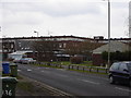
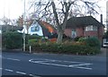
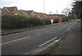

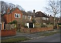
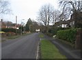
100 photos from this area
Area Information
Key information about the GU14 8LE including its size, population, and administrative classification.
- Area Type
- Postcode
- Area Size
- 1.1 hectares
- Population
- 1743
- Population Density
- 7747 people/km²
House Prices in GU14 8LE
40
Properties
£170,697
Average Sold Price
£44,000
Lowest Price
£290,000
Highest Price
Showing 40 properties
| Address | Type | Beds | Baths | Last Sale Price | Last Sale Date | |
|---|---|---|---|---|---|---|
| 4 Austen Road, Farnborough, GU14 8LE | Terraced | 3 | 1 | £290,000 | Apr 2022 | |
| 35 Austen Road, Farnborough, GU14 8LE | Terraced | 3 | 1 | £230,000 | Mar 2020 | |
| 38 Austen Road, Farnborough, GU14 8LE | Terraced | 3 | - | £257,500 | Apr 2017 | |
| 31 Austen Road, Farnborough, GU14 8LE | Terraced | 3 | 1 | £282,000 | Mar 2017 | |
| 26 Austen Road, Farnborough, GU14 8LE | Terraced | 3 | - | £205,000 | Jul 2014 | |
| 24 Austen Road, Farnborough, GU14 8LE | Semi-detached | 3 | 1 | £195,000 | Apr 2014 | |
| 37 Austen Road, Farnborough, GU14 8LE | Terraced | 3 | - | £160,000 | Sep 2011 | |
| 6 Austen Road, Farnborough, GU14 8LE | house | - | - | £134,950 | Apr 2009 | |
| 20 Austen Road, Farnborough, GU14 8LE | Terraced | 3 | 1 | £128,000 | Jan 2009 | |
| 10 Austen Road, Farnborough, GU14 8LE | house | - | - | £172,000 | Oct 2007 |
Page 1 of 4
Energy Efficiency in GU14 8LE
Amenities
Schools
| Rank | School | Type | Entry gender | Ages |
|---|
Explore more schools in this area
Go to Schools tabDemographics
Household Size
Family (3-5 people)
most common
Accommodation Type
Houses
most common
Tenure
52
majority
Ethnic Group
White
most common
Religion
N/A
most common
Household Composition
N/A
most common
Age
47
median
Adults (30-64 years)
most common
Household Deprivation
N/A
with no deprivation
NS-SEC
20
in Lower managerial occupations
Explore more demographic insights in this area
Go to Demographics tabPlanning
Planning Constraints
- Flood RiskPremium
- Ramsar Wetland SitesPremium
- Area of Outstanding Natural BeautyPremium
- Protected Nature ReservePremium
- Protected WoodlandPremium