Area Overview for GU14 8AJ
Photos of GU14 8AJ
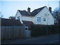
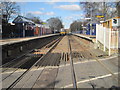
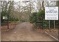
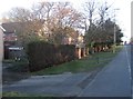
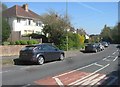
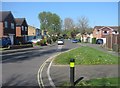
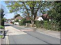
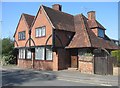
100 photos from this area
Area Information
Key information about the GU14 8AJ including its size, population, and administrative classification.
- Area Type
- Postcode
- Area Size
- 1.3 hectares
- Population
- 1568
- Population Density
- 1596 people/km²
House Prices in GU14 8AJ
14
Properties
£394,167
Average Sold Price
£80,000
Lowest Price
£775,000
Highest Price
Showing 14 properties
| Address | Type | Beds | Baths | Last Sale Price | Last Sale Date | |
|---|---|---|---|---|---|---|
| 163 Rectory Road, Farnborough, GU14 8AJ | Detached | 4 | 3 | £775,000 | Nov 2024 | |
| 185 Rectory Road, Farnborough, GU14 8AJ | house | - | - | £520,000 | Aug 2022 | |
| 175 Rectory Road, Farnborough, GU14 8AJ | Semi-detached | 2 | 2 | £330,000 | Feb 2021 | |
| 187 Rectory Road, Farnborough, GU14 8AJ | Bungalow | 3 | 2 | £390,000 | Apr 2015 | |
| 171 Rectory Road, Farnborough, GU14 8AJ | Semi-detached | 3 | 1 | £270,000 | Sep 2014 | |
| 183 Rectory Road, Farnborough, GU14 8AJ | Semi-detached | - | - | £80,000 | Aug 1995 | |
| 165A Rectory Road, Farnborough, GU14 8AJ | Semi-detached | 4 | 2 | - | - | |
| 165 Rectory Road, Farnborough, GU14 8AJ | Detached | - | - | - | - | |
| Annexe, 163 Rectory Road, Farnborough, GU14 8AJ | Flat | - | - | - | - | |
| 177 Rectory Road, Farnborough, GU14 8AJ | Detached | - | - | - | - |
Page 1 of 2
Energy Efficiency in GU14 8AJ
Amenities
Schools
| Rank | School | Type | Entry gender | Ages |
|---|
Explore more schools in this area
Go to Schools tabDemographics
Household Size
Two person
most common
Accommodation Type
Houses
most common
Tenure
83
majority
Ethnic Group
White
most common
Religion
N/A
most common
Household Composition
N/A
most common
Age
47
median
Adults (30-64 years)
most common
Household Deprivation
N/A
with no deprivation
NS-SEC
44
in Lower managerial occupations
Explore more demographic insights in this area
Go to Demographics tabPlanning
Planning Constraints
- Flood RiskPremium
- Ramsar Wetland SitesPremium
- Area of Outstanding Natural BeautyPremium
- Protected Nature ReservePremium
- Protected WoodlandPremium