Area Overview for GU14 7HS
Photos of GU14 7HS
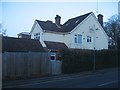
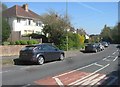
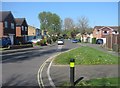
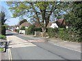
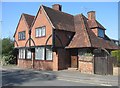
100 photos from this area
Area Information
Key information about the GU14 7HS including its size, population, and administrative classification.
- Area Type
- Postcode
- Area Size
- 4.0 hectares
- Population
- 2343
- Population Density
- 2984 people/km²
House Prices in GU14 7HS
31
Properties
£286,857
Average Sold Price
£154,000
Lowest Price
£485,000
Highest Price
Showing 31 properties
| Address | Type | Beds | Baths | Last Sale Price | Last Sale Date | |
|---|---|---|---|---|---|---|
| 119 Rectory Road, Farnborough, GU14 7HS | Bungalow | 2 | 1 | £390,000 | Dec 2024 | |
| 125 Rectory Road, Farnborough, GU14 7HS | Bungalow | - | - | £344,000 | Sep 2021 | |
| 101 Rectory Road, Farnborough, GU14 7HS | Detached | 3 | 1 | £355,000 | Jul 2020 | |
| 115 Rectory Road, Farnborough, GU14 7HS | Semi-detached | 2 | 1 | £360,000 | May 2019 | |
| 117 Rectory Road, Farnborough, GU14 7HS | Bungalow | 2 | 1 | £362,000 | Sep 2017 | |
| 111 Rectory Road, Farnborough, GU14 7HS | Semi-detached | 4 | 1 | £485,000 | Sep 2015 | |
| 137 Rectory Road, Farnborough, GU14 7HS | Bungalow | 3 | 2 | £340,000 | Sep 2014 | |
| 131 Rectory Road, Farnborough, GU14 7HS | Semi-detached | 2 | - | £275,500 | Sep 2014 | |
| 109 Rectory Road, Farnborough, GU14 7HS | Semi-detached | 3 | - | £293,000 | Sep 2013 | |
| 127 Rectory Road, Farnborough, GU14 7HS | Bungalow | 2 | 1 | £268,000 | Aug 2013 |
Page 1 of 4
Energy Efficiency in GU14 7HS
Amenities
Schools
| Rank | School | Type | Entry gender | Ages |
|---|
Explore more schools in this area
Go to Schools tabDemographics
Household Size
Family (3-5 people)
most common
Accommodation Type
Houses
most common
Tenure
68
majority
Ethnic Group
White
most common
Religion
N/A
most common
Household Composition
N/A
most common
Age
47
median
Adults (30-64 years)
most common
Household Deprivation
N/A
with no deprivation
NS-SEC
49
in Lower managerial occupations
Explore more demographic insights in this area
Go to Demographics tabPlanning
Planning Constraints
- Flood RiskPremium
- Ramsar Wetland SitesPremium
- Area of Outstanding Natural BeautyPremium
- Protected Nature ReservePremium
- Protected WoodlandPremium