Area Overview for GU12 5HN
Photos of GU12 5HN
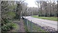
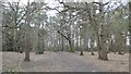
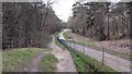
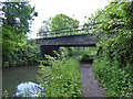
77 photos from this area
Area Information
Key information about the GU12 5HN including its size, population, and administrative classification.
- Area Type
- Postcode
- Area Size
- 1.3 hectares
- Population
- 1430
- Population Density
- 886 people/km²
House Prices in GU12 5HN
27
Properties
£208,907
Average Sold Price
£59,999
Lowest Price
£420,000
Highest Price
Showing 27 properties
| Address | Type | Beds | Baths | Last Sale Price | Last Sale Date | |
|---|---|---|---|---|---|---|
| 35 Burrwood Gardens, Ash Vale, GU12 5HN | Semi-detached | 3 | 2 | £420,000 | Oct 2023 | |
| 25 Burrwood Gardens, Ash Vale, GU12 5HN | Terraced | 3 | - | £346,000 | Jul 2018 | |
| 29 Burrwood Gardens, Ash Vale, GU12 5HN | house | - | - | £269,250 | Mar 2017 | |
| 17 Burrwood Gardens, Ash Vale, GU12 5HN | Terraced | 3 | - | £295,000 | Dec 2016 | |
| 8 Burrwood Gardens, Ash Vale, GU12 5HN | Terraced | 3 | - | £203,145 | Jul 2013 | |
| 12 Burrwood Gardens, Ash Vale, GU12 5HN | Terraced | 3 | 1 | £190,000 | Dec 2009 | |
| 16 Burrwood Gardens, Ash Vale, GU12 5HN | house | - | - | £249,950 | Apr 2007 | |
| 15 Burrwood Gardens, Ash Vale, GU12 5HN | Terraced | - | - | £209,950 | Dec 2006 | |
| 21 Burrwood Gardens, Ash Vale, GU12 5HN | Terraced | - | - | £156,500 | May 2003 | |
| 22 Burrwood Gardens, Ash Vale, GU12 5HN | Terraced | - | - | £158,000 | Jun 2002 |
Page 1 of 3
Energy Efficiency in GU12 5HN
Amenities
Schools
| Rank | School | Type | Entry gender | Ages |
|---|
Explore more schools in this area
Go to Schools tabDemographics
Household Size
Two person
most common
Accommodation Type
Houses
most common
Tenure
86
majority
Ethnic Group
White
most common
Religion
N/A
most common
Household Composition
N/A
most common
Age
47
median
Adults (30-64 years)
most common
Household Deprivation
N/A
with no deprivation
NS-SEC
47
in Lower managerial occupations
Explore more demographic insights in this area
Go to Demographics tabPlanning
Planning Constraints
- Flood RiskPremium
- Ramsar Wetland SitesPremium
- Area of Outstanding Natural BeautyPremium
- Protected Nature ReservePremium
- Protected WoodlandPremium