Area Overview for GU12 5HJ
Photos of GU12 5HJ
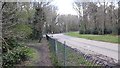
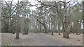
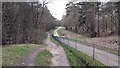
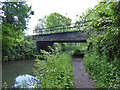
77 photos from this area
Area Information
Key information about the GU12 5HJ including its size, population, and administrative classification.
- Area Type
- Postcode
- Area Size
- 1.3 hectares
- Population
- 1430
- Population Density
- 886 people/km²
House Prices in GU12 5HJ
16
Properties
£260,636
Average Sold Price
£207,000
Lowest Price
£340,000
Highest Price
Showing 16 properties
| Address | Type | Beds | Baths | Last Sale Price | Last Sale Date | |
|---|---|---|---|---|---|---|
| 28 Vale Road, Ash Vale, GU12 5HJ | Semi-detached | 3 | 2 | £340,000 | Dec 2024 | |
| Olive Cottage, 24 Vale Road, Ash Vale, GU12 5HJ | Detached | 2 | - | £249,950 | Sep 2014 | |
| 46 Vale Road, Ash Vale, GU12 5HJ | Bungalow | 2 | - | £242,500 | Jul 2013 | |
| 48 Vale Road, Ash Vale, GU12 5HJ | house | - | - | £240,000 | Mar 2013 | |
| 32 Vale Road, Ash Vale, GU12 5HJ | Semi-detached | 3 | 1 | £207,000 | Dec 2011 | |
| 40 Vale Road, Ash Vale, GU12 5HJ | Bungalow | 5 | - | £325,000 | Sep 2011 | |
| 18 Vale Road, Ash Vale, GU12 5HJ | Terraced | - | - | £220,000 | Aug 2003 | |
| 16 Vale Road, Ash Vale, GU12 5HJ | Detached | 3 | 1 | - | - | |
| 2 Vale Road, Ash Vale, GU12 5HJ | Retail | 2 | - | - | - | |
| Pats Newsagent, 10-12 Vale Road, Ash Vale, GU12 5HJ | shop | - | - | - | - |
Page 1 of 2
Energy Efficiency in GU12 5HJ
Amenities
Schools
| Rank | School | Type | Entry gender | Ages |
|---|
Explore more schools in this area
Go to Schools tabDemographics
Household Size
Two person
most common
Accommodation Type
Houses
most common
Tenure
86
majority
Ethnic Group
White
most common
Religion
N/A
most common
Household Composition
N/A
most common
Age
47
median
Adults (30-64 years)
most common
Household Deprivation
N/A
with no deprivation
NS-SEC
47
in Lower managerial occupations
Explore more demographic insights in this area
Go to Demographics tabPlanning
Planning Constraints
- Flood RiskPremium
- Ramsar Wetland SitesPremium
- Area of Outstanding Natural BeautyPremium
- Protected Nature ReservePremium
- Protected WoodlandPremium