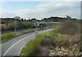
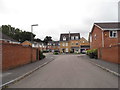
Area Overview for GU12 4UG
Photos of GU12 4UG


Area Information
GU12 4UG is a compact, densely populated residential postcode in England, covering just 2.4 hectares yet home to 2,392 residents. Its high population density of 98,025 people per square kilometre reflects a tightly knit community. The area is characterised by a mature demographic, with a median age of 47 and a majority of residents aged 30–64. This suggests a stable, established population, likely centred around family homes and long-term residency. The area’s small size means it is a self-contained cluster, with nearby amenities such as Co-op stores, railway stations, and Farnborough Airport within practical reach. While its density may feel intimate, it also implies limited expansion, making it a fixed, localised community. For those seeking a quiet, residential environment with essential services close by, GU12 4UG offers a blend of convenience and continuity, though its compact nature means residents are likely to know their neighbours well.
- Area Type
- Postcode
- Area Size
- 2.4 hectares
- Population
- 2392
- Population Density
- 6280 people/km²
GU12 4UG is predominantly an owner-occupied area, with 74% of residents living in homes they own. The accommodation type is mainly houses, which implies a focus on single-family residences rather than apartments or flats. This suggests a market skewed towards private ownership, likely attracting buyers seeking long-term stability or family homes. The area’s small size means the housing stock is limited, but its proximity to amenities such as railway stations and retail hubs may enhance its appeal. For buyers, this could mean a competitive market with fewer properties available, though the immediate surrounding areas may offer more options. The high home ownership rate also indicates a community with established residents, which could be a draw for those seeking a settled, residential environment.
House Prices in GU12 4UG
Showing 38 properties
| Address | Type | Beds | Baths | Last Sale Price | Last Sale Date | |
|---|---|---|---|---|---|---|
| 13 Field Way, Aldershot, GU12 4UG | house | - | - | £400,000 | Sep 2024 | |
| 25 Field Way, Aldershot, GU12 4UG | Bungalow | 3 | 1 | £355,000 | Aug 2024 | |
| 38 Field Way, Aldershot, GU12 4UG | Semi-detached | 3 | 1 | £425,000 | May 2023 | |
| 5 Field Way, Aldershot, GU12 4UG | Retail | 3 | 1 | £340,000 | Mar 2022 | |
| 9 Field Way, Aldershot, GU12 4UG | Bungalow | - | - | £297,000 | Nov 2016 | |
| 2 Field Way, Aldershot, GU12 4UG | Bungalow | - | - | £319,950 | Nov 2015 | |
| 11 Field Way, Aldershot, GU12 4UG | Bungalow | - | - | £280,000 | Aug 2015 | |
| 44 Field Way, Aldershot, GU12 4UG | house | - | - | £200,000 | Jul 2014 | |
| 1 Field Way, Aldershot, GU12 4UG | Semi-detached | 2 | - | £235,000 | Mar 2013 | |
| 6 Field Way, Aldershot, GU12 4UG | Bungalow | - | - | £200,000 | Oct 2012 |
Energy Efficiency in GU12 4UG
Living in GU12 4UG offers access to essential retail and transport hubs. Nearby Co-op stores, including Co-op Aldershot and Sainsburys Aldershot, provide everyday shopping convenience. The area’s rail network, with stations such as Ash and Aldershot, connects residents to broader regional routes, facilitating commuting or weekend travel. Farnborough Airport is within practical reach, offering additional travel options. While the area lacks detailed data on parks or leisure facilities, its proximity to retail and transport suggests a lifestyle focused on practicality and accessibility. The compact nature of GU12 4UG means amenities are close, fostering a sense of convenience for daily needs, though residents may need to travel slightly further for more specialised services.
Amenities
Schools
| Rank | School | Type | Entry gender | Ages |
|---|
Explore more schools in this area
Go to Schools tabDemographics
The population of GU12 4UG is predominantly adults aged 30–64, with a median age of 47. This indicates a mature, stable community with a strong presence of middle-aged residents, likely including families and professionals. Home ownership is high at 74%, suggesting a majority of residents live in properties they own rather than rent. The accommodation type is primarily houses, which aligns with the area’s residential character and may reflect a preference for private, family-oriented living. The predominant ethnic group is White, though no data on diversity or deprivation is provided. The high home ownership rate and age profile suggest a community with long-term residency and a focus on stability, though the lack of specific data on diversity means the full demographic picture remains incomplete.
Household Size
Accommodation Type
Tenure
Ethnic Group
Religion
Household Composition
Age
Household Deprivation
NS-SEC
Explore more demographic insights in this area
Go to Demographics tabPlanning
Planning Constraints
- Flood RiskPremium
- Ramsar Wetland SitesPremium
- Area of Outstanding Natural BeautyPremium
- Protected Nature ReservePremium
- Protected WoodlandPremium