Area Overview for GU12 4NQ
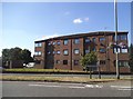
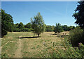
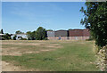
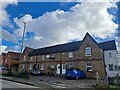
Photos of GU12 4NQ


Area Information
GU12 4NQ is a compact residential postcode area in England, covering just 1.5 hectares yet home to 2,494 residents. Its high population density of 164,735 people per square kilometre reflects a tightly knit community, where the average resident is 47 years old, with adults aged 30–64 forming the largest demographic. This area is defined by its proximity to essential services and transport links, making it practical for daily life. The presence of multiple schools, retail outlets, and rail stations within walking distance suggests a focus on convenience. With broadband scores of 98 and mobile coverage of 83, digital connectivity is robust, supporting remote work and online activities. The area’s small size means it is likely surrounded by similar residential clusters, creating a cohesive local environment. For those seeking a balance between urban accessibility and residential comfort, GU12 4NQ offers a mix of practicality and community-centric living.
- Area Type
- Postcode
- Area Size
- 1.5 hectares
- Population
- 2494
- Population Density
- 4422 people/km²
GU12 4NQ is a small area where 51% of residents own their homes, with houses being the primary accommodation type. This suggests a market skewed towards owner-occupation, though the remaining 49% likely represents rental properties. The compact size of the area—just 1.5 hectares—means the housing stock is limited, potentially leading to competition for available properties. The predominance of houses over flats indicates a focus on family-friendly or larger homes, which may appeal to the area’s mature demographic. For buyers, this small postcode area may require looking beyond immediate surroundings to find additional options. The high population density suggests that properties here are likely in demand, with proximity to schools, transport, and retail serving as key selling points. However, the limited size of the area means that property availability could be constrained, particularly for those seeking specific types of homes.
House Prices in GU12 4NQ
Showing 90 properties
| Address | Type | Beds | Baths | Last Sale Price | Last Sale Date | |
|---|---|---|---|---|---|---|
| 103 Harvest Lane, Aldershot, GU12 4NQ | Flat | 2 | 1 | - | - | |
| 21 Harvest Lane, Aldershot, GU12 4NQ | Flat | 1 | 1 | - | - | |
| 131 Harvest Lane, Aldershot, GU12 4NQ | Flat | 2 | 1 | - | - | |
| 65 Harvest Lane, Aldershot, GU12 4NQ | house | - | - | - | - | |
| 69 Harvest Lane, Aldershot, GU12 4NQ | Flat | - | - | - | - | |
| 91 Harvest Lane, Aldershot, GU12 4NQ | Flat | - | - | - | - | |
| 7 Harvest Lane, Aldershot, GU12 4NQ | Flat | - | - | - | - | |
| 5 Harvest Lane, Aldershot, GU12 4NQ | Flat | - | - | - | - | |
| 101 Harvest Lane, Aldershot, GU12 4NQ | Flat | - | - | - | - | |
| 27 Harvest Lane, Aldershot, GU12 4NQ | Flat | - | - | - | - |
Energy Efficiency in GU12 4NQ
The lifestyle in GU12 4NQ is shaped by its proximity to essential amenities. Retail options include five venues, such as Co-op Aldershot, Co-op Ash, and Sainsburys Aldershot, providing everyday shopping convenience. The area’s rail stations—Aldershot, Ash, and Ash Vale—offer easy access to commuting, leisure, and regional travel. Farnborough Airport is within practical reach, adding to the area’s appeal for those requiring air travel. While the data does not specify parks or leisure facilities, the presence of multiple retail and transport hubs suggests a focus on practicality and accessibility. Residents benefit from a compact layout that minimises travel time to services, creating a lifestyle that prioritises efficiency. The combination of retail, transport, and nearby airports ensures that daily needs are met without the need for long journeys.
Amenities
Schools
Residents of GU12 4NQ have access to two primary schools: Alderwood School, which holds a ‘good’ Ofsted rating, and Belle Vue County Infant School. These institutions provide early education for children, with Alderwood’s positive rating indicating a commitment to quality teaching and facilities. The presence of two primary schools within practical reach is a significant advantage for families, reducing the need for long commutes. Both schools cater to younger children, suggesting that the area is well-suited for families with young dependents. The absence of secondary schools in the data implies that older students may need to travel to nearby towns for further education. Nonetheless, the availability of primary schools enhances the area’s appeal for households prioritising convenient schooling options.
| Rank | School | Type | Entry gender | Ages |
|---|
Explore more schools in this area
Go to Schools tabDemographics
The population of GU12 4NQ is predominantly adults, with 30–64-year-olds making up the most common age range. The median age of 47 indicates a mature, stable community, likely with established families and professionals. Home ownership stands at 51%, suggesting a mix of owner-occupied properties and rental homes. The area is characterised by houses rather than flats, aligning with the demographic profile of older, settled residents. The predominant ethnic group is White, which shapes the cultural and social fabric of the area. The high population density of 164,735 people per square kilometre implies a compact, possibly multi-generational living environment. This density may influence local services and infrastructure, ensuring proximity to amenities but potentially limiting space for expansion. The data does not indicate significant deprivation, but the age profile suggests a community focused on long-term stability rather than transient lifestyles.
Household Size
Accommodation Type
Tenure
Ethnic Group
Religion
Household Composition
Age
Household Deprivation
NS-SEC
Explore more demographic insights in this area
Go to Demographics tabPlanning
Planning Constraints
- Flood RiskPremium
- Ramsar Wetland SitesPremium
- Area of Outstanding Natural BeautyPremium
- Protected Nature ReservePremium
- Protected WoodlandPremium