Area Overview for GU12 4TA
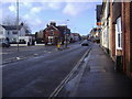
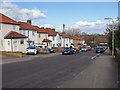
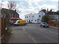
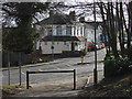
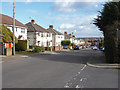
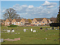
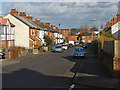
Photos of GU12 4TA


Area Information
GU12 4TA is a compact residential postcode in England, covering 2,781 square metres and home to 2,494 residents. Its high population density of 896,661 people per square kilometre reflects a tightly knit community, though the area remains small enough to foster familiarity among neighbours. The postcode is characterised by a predominance of houses, with 51% of residents owning their homes. This suggests a stable, long-term population, with a median age of 47 and a majority of adults aged 30–64. Living here means proximity to essential services, including five retail outlets such as Co-op Aldershot and Sainsburys Aldershot, and five rail stations, including Aldershot and Ash Vale. The area’s digital connectivity is exceptional, with a broadband score of 98 and mobile coverage of 83, ensuring seamless online access for work or leisure. For families, the presence of Alderwood School and Belle Vue County Infant School, both rated ‘good’ or ungraded, adds to the appeal. While the area’s small size may limit expansion, its blend of practicality, connectivity, and community makes it a compelling choice for those seeking a balanced lifestyle.
- Area Type
- Postcode
- Area Size
- 2781 m²
- Population
- 2494
- Population Density
- 4422 people/km²
GU12 4TA is primarily a home-ownership area, with 51% of residents owning their properties. The housing stock consists almost entirely of houses, not flats, which is uncommon in more densely populated urban areas. This suggests a market skewed towards family homes and long-term residents, rather than short-term rentals or student accommodation. The small size of the postcode (2,781 m²) means the housing stock is limited, potentially leading to competition for properties. Buyers should consider the proximity to rail stations—Aldershot, Ash, and Ash Vale—offering easy access to regional transport networks. The area’s compact nature also means that properties are likely to be close to amenities such as schools and retail. However, the lack of flats or larger developments may limit options for those seeking different housing types. For buyers, the focus should be on the area’s stability, with a median age of 47 indicating a mature population less likely to move frequently.
House Prices in GU12 4TA
Showing 21 properties
| Address | Type | Beds | Baths | Last Sale Price | Last Sale Date | |
|---|---|---|---|---|---|---|
| 163 North Lane, Aldershot, GU12 4TA | undefined | - | - | - | - | |
| Flat 1, 161 North Lane, Aldershot, GU12 4TA | Flat | - | - | - | - | |
| Flat 4, 163 North Lane, Aldershot, GU12 4TA | Flat | - | - | - | - | |
| Flat 1, 163 North Lane, Aldershot, GU12 4TA | Flat | - | - | - | - | |
| Flat 2, 163 North Lane, Aldershot, GU12 4TA | Flat | 1 | 1 | - | - | |
| Flat 5, 163 North Lane, Aldershot, GU12 4TA | Flat | 2 | 1 | - | - | |
| Flat 3, 163 North Lane, Aldershot, GU12 4TA | Flat | - | - | - | - | |
| Living Accommodation, 161 North Lane, Aldershot, GU12 4TA | Flat | - | - | - | - | |
| Flat 4, 161 North Lane, Aldershot, GU12 4TA | Maisonette | - | - | - | - | |
| Flat 3, 161 North Lane, Aldershot, GU12 4TA | Maisonette | - | - | - | - |
Energy Efficiency in GU12 4TA
Residents of GU12 4TA benefit from a range of nearby amenities, including five retail outlets such as Co-op Aldershot and Sainsburys Aldershot, offering everyday shopping needs. The area’s rail stations—Aldershot, Ash, and Ash Vale—provide easy access to regional transport, while Farnborough Airport is within reach for those requiring air travel. Though the data does not specify parks or leisure facilities, the compact nature of the postcode suggests that local amenities may be limited to essential services. The presence of two primary schools and a high broadband score indicates a focus on family-friendly infrastructure and digital convenience. The area’s small size means that amenities are likely to be within walking or cycling distance, promoting a lifestyle that prioritises accessibility over sprawling developments. While the data does not mention dining or recreational options, the proximity to rail stations may open up opportunities for dining or leisure in nearby towns.
Amenities
Schools
Residents of GU12 4TA have access to two primary schools: Alderwood School, which holds an Ofsted rating of ‘good’, and Belle Vue County Infant School, which is ungraded but likely to serve younger children. Both institutions cater to primary education, making the area suitable for families with young children. The presence of two primary schools suggests a focus on early education, though the absence of secondary schools in the data means families may need to look further afield for secondary education. Alderwood School’s ‘good’ rating indicates a satisfactory standard of teaching and facilities, while Belle Vue County Infant School may offer a more traditional or specialist approach. The proximity of these schools to homes in GU12 4TA reduces commuting time for parents, enhancing the area’s appeal for families. However, the lack of data on school capacity or pupil numbers means it is unclear whether demand for places may outstrip supply.
| Rank | School | Type | Entry gender | Ages |
|---|
Explore more schools in this area
Go to Schools tabDemographics
The population of GU12 4TA skews heavily towards adults aged 30–64, with a median age of 47. This suggests a community of established professionals and families, rather than a younger or elderly demographic. Home ownership stands at 51%, with the remaining 49% likely to be renters, indicating a mix of long-term residents and transient occupants. The area is predominantly composed of houses, not flats, which aligns with the age profile of homeownership. The predominant ethnic group is White, though specific data on diversity or deprivation is not provided. The high population density of 896,661 people per square kilometre implies a compact, possibly urban setting, though the area’s small size (2,781 m²) means it is unlikely to have sprawling infrastructure. This density may contribute to a sense of community but could also mean limited green space or congestion. The absence of detailed deprivation data means quality of life factors such as income levels or access to services remain unquantified, though the presence of schools and retail suggests adequate provision for daily needs.
Household Size
Accommodation Type
Tenure
Ethnic Group
Religion
Household Composition
Age
Household Deprivation
NS-SEC
Explore more demographic insights in this area
Go to Demographics tabPlanning
Planning Constraints
- Flood RiskPremium
- Ramsar Wetland SitesPremium
- Area of Outstanding Natural BeautyPremium
- Protected Nature ReservePremium
- Protected WoodlandPremium