Area Overview for GU12 4DX
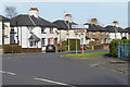
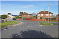
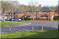
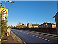
Photos of GU12 4DX


Area Information
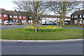
Living in GU12 4DX offers a compact, tightly knit residential experience within a 1.5-hectare area. With a population of 1,850 and a density of 121,029 people per square kilometre, this postcode area is a small cluster of homes, predominantly houses, catering to a mature demographic. The community is defined by its proximity to Aldershot, with easy access to rail links and local amenities. Daily life here balances quiet residential living with practical connectivity. Residents benefit from low flood risk, a crime score of 78/100, and no environmental constraints like protected woodlands or AONB areas. The area’s small size means a strong sense of community, though its limited footprint means housing options are focused on owner-occupied properties. For those seeking a low-maintenance, secure environment with access to nearby towns and transport, GU12 4DX provides a straightforward, no-frills living experience.
- Area Type
- Postcode
- Area Size
- 1.5 hectares
- Population
- 1850
- Population Density
- 4787 people/km²
The property market in GU12 4DX is characterised by a high rate of home ownership—60% of properties are owner-occupied—suggesting a stable, long-term resident base. The area is dominated by houses rather than flats, which aligns with its traditional, low-density residential profile. Given the postcode’s small size (1.5 hectares), the housing stock is limited, making it a niche market for buyers seeking a compact, secure environment. The absence of rental-focused properties implies that most homes are occupied by owners, potentially reducing competition for tenants. For buyers, this means a focus on existing housing rather than new developments. The proximity to Aldershot’s rail network and retail hubs may enhance the area’s appeal, though the small footprint means opportunities for expansion are constrained.
House Prices in GU12 4DX
No properties found in this postcode.
Energy Efficiency in GU12 4DX
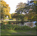
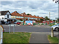
GU12 4DX’s lifestyle is shaped by its proximity to practical amenities. Within reach are five retail outlets, including Sainsburys Aldershot and The Southern Co-operative Co, offering everyday shopping needs. The area’s rail network, with stations at Aldershot, Ash, and Ash Vale, provides easy access to larger towns and services. Farnborough Airport adds another layer of connectivity for travel. While the area itself is compact, its integration with Aldershot means residents can access a wider range of dining, leisure, and cultural options nearby. The absence of parks or recreational spaces within the postcode suggests that outdoor activities may require travel to adjacent areas. Nonetheless, the combination of retail, transport, and air links ensures a functional, convenience-driven lifestyle for residents.
Amenities
Schools
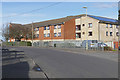
The Connaught School, a primary school, is the only educational institution explicitly listed near GU12 4DX. While no Ofsted rating is provided, its presence indicates access to early education for local families. The absence of secondary schools or additional primary schools suggests that families may need to travel to nearby towns for secondary education or broader educational options. For those prioritising proximity to schools, The Connaught School offers a practical resource, though the limited range of institutions may require planning for longer commutes. The single school in the area reflects the postcode’s small size and its role as a satellite to larger educational hubs in Aldershot or surrounding regions.
| Rank | School | Type | Entry gender | Ages |
|---|
Explore more schools in this area
Go to Schools tabDemographics
GU12 4DX’s population skews towards adults aged 30–64, with a median age of 47. This suggests a community of established professionals and families, many of whom own their homes—60% of properties are owner-occupied. The area is predominantly composed of houses, not flats, reflecting a traditional housing stock. The predominant ethnic group is White, with no specific data on other demographics. The high population density, 121,029 people per square kilometre, indicates a tightly packed residential area, which may influence social dynamics and local services. While no deprivation data is provided, the low crime rate and absence of environmental restrictions suggest a stable, low-risk environment for residents. The age profile implies a community with strong local ties, though the small area size may limit opportunities for diverse social or cultural engagement.
Household Size
Accommodation Type
Tenure
Ethnic Group
Religion
Household Composition
Age
Household Deprivation
NS-SEC
Explore more demographic insights in this area
Go to Demographics tabPlanning
Planning Constraints
- Flood RiskPremium
- Ramsar Wetland SitesPremium
- Area of Outstanding Natural BeautyPremium
- Protected Nature ReservePremium
- Protected WoodlandPremium