Area Overview for GU11 4EW
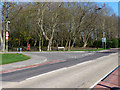
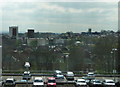
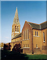
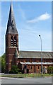
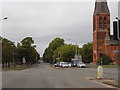
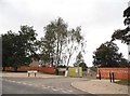
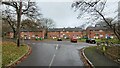
Photos of GU11 4EW


Area Information
GU11 4EW is a small residential postcode area in England, covering 4930 square metres and home to 2169 residents. Its compact size means it is a tightly knit community, with a population density of 929 people per square kilometre. The area is characterised by its proximity to essential services and transport links, making it practical for daily living. With a median age of 22, the population skews younger than the national average, though the most common age range is adults aged 30–64. This blend of demographics suggests a mix of established residents and younger professionals or families. The area’s housing stock consists primarily of houses, reflecting a suburban or semi-rural setting. Residents benefit from nearby retail outlets, rail stations, and an airport, ensuring connectivity to surrounding regions. While the area is small, its strategic location offers access to broader networks, balancing local convenience with regional reach.
- Area Type
- Postcode
- Area Size
- 4930 m²
- Population
- 2169
- Population Density
- 929 people/km²
The property market in GU11 4EW is shaped by its low home ownership rate of 18%, suggesting that the area is primarily a rental market rather than one dominated by owner-occupied homes. The accommodation type is predominantly houses, which may indicate a preference for larger properties, though the small area size means the housing stock is limited. For buyers, this implies that available homes are likely to be in the rental sector, with fewer opportunities for purchase. The compact nature of the postcode means that the immediate surrounding areas may offer similar housing options, but the overall market is constrained by the area’s size. Those seeking to buy may need to consider broader regions for more choices, while renters benefit from the availability of houses in a closely knit community.
House Prices in GU11 4EW
Showing 51 properties
| Address | Type | Beds | Baths | Last Sale Price | Last Sale Date | |
|---|---|---|---|---|---|---|
| 5 Leishman Views, Wellesley, Aldershot, GU11 4EW | Flat | - | - | £372,000 | Aug 2025 | |
| 35 Leishman Views, Wellesley, Aldershot, GU11 4EW | house | - | - | £480,000 | Apr 2024 | |
| 28 Leishman Views, Wellesley, Aldershot, GU11 4EW | house | - | - | £732,500 | Mar 2024 | |
| 36 Leishman Views, Wellesley, Aldershot, GU11 4EW | house | - | - | £485,000 | Feb 2024 | |
| 22 Leishman Views, Wellesley, Aldershot, GU11 4EW | house | - | - | £492,500 | Aug 2023 | |
| 32 Leishman Views, Wellesley, Aldershot, GU11 4EW | Bungalow | 1 | 1 | £350,000 | May 2023 | |
| 34 Leishman Views, Wellesley, Aldershot, GU11 4EW | house | - | - | £490,000 | May 2023 | |
| 29 Leishman Views, Wellesley, Aldershot, GU11 4EW | Terraced | 3 | 2 | £500,000 | Apr 2023 | |
| 30 Leishman Views, Wellesley, Aldershot, GU11 4EW | house | - | - | £510,000 | Apr 2023 | |
| 33 Leishman Views, Wellesley, Aldershot, GU11 4EW | Flat | 1 | 1 | £290,000 | Mar 2023 |
Energy Efficiency in GU11 4EW
Living in GU11 4EW offers access to a range of local amenities within practical reach. Retail options include Lidl Central, Iceland Aldershot, and Co-op Aldershot, providing essential shopping and grocery needs. The area’s rail network connects residents to Aldershot, North Camp, and Ash stations, facilitating easy travel to nearby towns and cities. Farnborough Airport is also nearby, offering additional transport flexibility. While the area is small, its proximity to these services ensures convenience for daily life. The presence of multiple retail outlets and transport hubs suggests a functional, community-focused environment. Residents can enjoy a mix of local shopping and efficient commuting, balancing practicality with accessibility.
Amenities
Schools
| Rank | School | Type | Entry gender | Ages |
|---|
Explore more schools in this area
Go to Schools tabDemographics
The community in GU11 4EW is predominantly composed of adults aged 30–64, making up the most common age range. This is contrasted by a median age of 22, suggesting a younger population also present, possibly students or early-career professionals. Home ownership is relatively low at 18%, indicating that the area is more rental-focused than owner-occupied. The predominant accommodation type is houses, which aligns with the suburban character of the area. The population is overwhelmingly White, with no specific data provided on other ethnic groups. The high population density of 929 people per square kilometre means the community is closely packed, which can influence social dynamics and local amenities. While no deprivation data is available, the combination of low home ownership and a focus on houses may reflect a mix of long-term residents and transient populations.
Household Size
Accommodation Type
Tenure
Ethnic Group
Religion
Household Composition
Age
Household Deprivation
NS-SEC
Explore more demographic insights in this area
Go to Demographics tabPlanning
Planning Constraints
- Flood RiskPremium
- Ramsar Wetland SitesPremium
- Area of Outstanding Natural BeautyPremium
- Protected Nature ReservePremium
- Protected WoodlandPremium