Area Overview for GU11 1NG
Photos of GU11 1NG
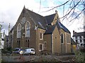
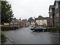
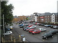
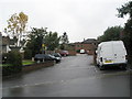
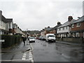
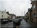
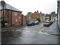
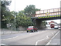
100 photos from this area
Area Information
Key information about the GU11 1NG including its size, population, and administrative classification.
- Area Type
- Postcode
- Area Size
- 2936 m²
- Population
- 1910
- Population Density
- 13741 people/km²
House Prices in GU11 1NG
21
Properties
£224,462
Average Sold Price
£45,000
Lowest Price
£355,000
Highest Price
Showing 21 properties
| Address | Type | Beds | Baths | Last Sale Price | Last Sale Date | |
|---|---|---|---|---|---|---|
| 58A Gordon Road, Aldershot, GU11 1NG | Semi-detached | 4 | 2 | £351,000 | Nov 2023 | |
| 58 Gordon Road, Aldershot, GU11 1NG | Flat | - | - | £351,000 | Nov 2023 | |
| 71 Gordon Road, Aldershot, GU11 1NG | Terraced | 3 | 1 | £355,000 | Feb 2023 | |
| 73 Gordon Road, Aldershot, GU11 1NG | Terraced | 3 | 1 | £321,000 | Dec 2022 | |
| 81 Gordon Road, Aldershot, GU11 1NG | Terraced | 4 | 2 | £280,000 | Jun 2019 | |
| 67 Gordon Road, Aldershot, GU11 1NG | Semi-detached | 3 | 1 | £305,000 | Sep 2016 | |
| 44 Gordon Road, Aldershot, GU11 1NG | Terraced | 4 | 1 | £300,000 | Jul 2016 | |
| 77 Gordon Road, Aldershot, GU11 1NG | Terraced | 4 | - | £217,000 | Oct 2012 | |
| 54 Gordon Road, Aldershot, GU11 1NG | house | - | - | £246,000 | Aug 2012 | |
| 75 Gordon Road, Aldershot, GU11 1NG | house | - | - | £257,500 | May 2012 |
Page 1 of 3
Energy Efficiency in GU11 1NG
Amenities
Schools
| Rank | School | Type | Entry gender | Ages |
|---|
Explore more schools in this area
Go to Schools tabDemographics
Household Size
Family (3-5 people)
most common
Accommodation Type
Flats
most common
Tenure
38
majority
Ethnic Group
White
most common
Religion
N/A
most common
Household Composition
N/A
most common
Age
47
median
Adults (30-64 years)
most common
Household Deprivation
N/A
with no deprivation
NS-SEC
18
in Lower managerial occupations
Explore more demographic insights in this area
Go to Demographics tabPlanning
Planning Constraints
- Flood RiskPremium
- Ramsar Wetland SitesPremium
- Area of Outstanding Natural BeautyPremium
- Protected Nature ReservePremium
- Protected WoodlandPremium