Area Overview for GU10 5AU
Photos of GU10 5AU


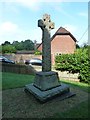
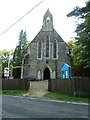

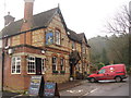
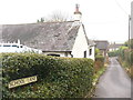
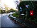
51 photos from this area
Area Information
Key information about the GU10 5AU including its size, population, and administrative classification.
- Area Type
- Postcode
- Area Size
- 6.2 hectares
- Population
- 1658
- Population Density
- 87 people/km²
House Prices in GU10 5AU
17
Properties
£565,392
Average Sold Price
£235,000
Lowest Price
£860,000
Highest Price
Showing 17 properties
| Address | Type | Beds | Baths | Last Sale Price | Last Sale Date | |
|---|---|---|---|---|---|---|
| 8, Old Queens Arms, Farnham Road, Ewshot, Farnham, GU10 5AU | Flat | - | - | £235,000 | Sep 2021 | |
| 9, Old Queens Arms, Farnham Road, Ewshot, Farnham, GU10 5AU | Flat | - | - | £382,350 | Sep 2021 | |
| South Winds, Farnham Road, Ewshot, Farnham, GU10 5AU | house | 4 | - | £610,000 | Aug 2013 | |
| Lines, Farnham Road, Ewshot, Farnham, GU10 5AU | Detached | 4 | - | £860,000 | Oct 2010 | |
| The Spinney, Farnham Road, Crondall, Farnham, GU10 5AU | Detached | - | - | £775,000 | Sep 2006 | |
| Queens View, Farnham Road, Ewshot, Farnham, GU10 5AU | Detached | - | - | £530,000 | Dec 2005 | |
| 2, Old Queens Arms, Farnham Road, Ewshot, Farnham, GU10 5AU | Flat | 1 | 1 | - | - | |
| Keepers Cottage, Farnham Road, Ewshot, Farnham, GU10 5AU | Semi-detached | 3 | 2 | - | - | |
| Flat 3, Keepers Cottage, Farnham Road, Ewshot, Farnham, GU10 5AU | Detached | 4 | - | - | - | |
| 6, Old Queens Arms, Farnham Road, Ewshot, Farnham, GU10 5AU | Flat | - | - | - | - |
Page 1 of 2
Energy Efficiency in GU10 5AU
Amenities
Schools
| Rank | School | Type | Entry gender | Ages |
|---|
Explore more schools in this area
Go to Schools tabDemographics
Household Size
Two person
most common
Accommodation Type
Houses
most common
Tenure
80
majority
Ethnic Group
White
most common
Religion
N/A
most common
Household Composition
N/A
most common
Age
47
median
Adults (30-64 years)
most common
Household Deprivation
N/A
with no deprivation
NS-SEC
48
in Lower managerial occupations
Explore more demographic insights in this area
Go to Demographics tabPlanning
Planning Constraints
- Flood RiskPremium
- Ramsar Wetland SitesPremium
- Area of Outstanding Natural BeautyPremium
- Protected Nature ReservePremium
- Protected WoodlandPremium