Area Overview for GU10 5AS
Photos of GU10 5AS
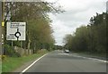


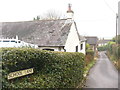
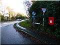
51 photos from this area
Area Information
Key information about the GU10 5AS including its size, population, and administrative classification.
- Area Type
- Postcode
- Area Size
- 16.3 hectares
- Population
- 1658
- Population Density
- 87 people/km²
House Prices in GU10 5AS
14
Properties
£615,750
Average Sold Price
£237,500
Lowest Price
£1,125,000
Highest Price
Showing 14 properties
| Address | Type | Beds | Baths | Last Sale Price | Last Sale Date | |
|---|---|---|---|---|---|---|
| Highgrove, Redlands Lane, Ewshot, Farnham, GU10 5AS | house | - | - | £1,125,000 | Aug 2021 | |
| Woodlands Corner, Redlands Lane, Ewshot, Farnham, GU10 5AS | Detached | 5 | 2 | £945,000 | Jun 2020 | |
| Tanglewood, Redlands Lane, Ewshot, Farnham, GU10 5AS | Detached | 3 | 1 | £675,000 | Dec 2014 | |
| Roseflint Cottage, Redlands Lane, Ewshot, Farnham, GU10 5AS | Detached | - | - | £237,500 | May 1999 | |
| Walden Wood House, Redlands Lane, Ewshot, Farnham, GU10 5AS | Detached | - | - | £274,000 | Apr 1995 | |
| Milford House, Redlands Lane, Ewshot, Farnham, GU10 5AS | Detached | 7 | 3 | £438,000 | Mar 1995 | |
| Redlands, Redlands Lane, Ewshot, Farnham, GU10 5AS | Detached | 5 | 2 | - | - | |
| Tremoon House, Redlands Lane, Ewshot, Farnham, GU10 5AS | house | 4 | - | - | - | |
| Offices, Redlands Farm, Redlands Lane, Ewshot, Farnham, GU10 5AS | Office | - | - | - | - | |
| Redlands Farm, Redlands Lane, Ewshot, Farnham, GU10 5AS | office_workshop | - | - | - | - |
Page 1 of 2
Energy Efficiency in GU10 5AS
Amenities
Schools
| Rank | School | Type | Entry gender | Ages |
|---|
Explore more schools in this area
Go to Schools tabDemographics
Household Size
Two person
most common
Accommodation Type
Houses
most common
Tenure
80
majority
Ethnic Group
White
most common
Religion
N/A
most common
Household Composition
N/A
most common
Age
47
median
Adults (30-64 years)
most common
Household Deprivation
N/A
with no deprivation
NS-SEC
48
in Lower managerial occupations
Explore more demographic insights in this area
Go to Demographics tabPlanning
Planning Constraints
- Flood RiskPremium
- Ramsar Wetland SitesPremium
- Area of Outstanding Natural BeautyPremium
- Protected Nature ReservePremium
- Protected WoodlandPremium