Area Overview for Epsom and Ewell District (B)
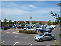
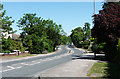
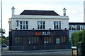
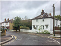
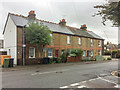
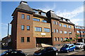
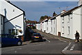
Photos of Epsom and Ewell District (B)


Area Information
Living in Epsom and Ewell District (B) means choosing a location defined by stability and a very mature demographic profile. This local authority district spans an area of 34.1 km², offering defined boundaries for those seeking a specific consensus on neighbourhood identity. The community here is exceptionally settled, with a median age of 70 years. This signifies an area populated largely by older residents who have put down roots for long periods. You are entering a space where daily life moves at a considered pace, driven by a population that prioritises permanence over substance. The 75% home ownership rate reinforces the character of this locality as a place where families and individuals stay for the long term. There are no transient rental communities here; instead, you find established households within a compact geographical zone. The ageing population is the defining statistic of Epsom and Ewell District (B), suggesting strong demand for healthcare amenities and accessible housing rather than nightlife or bustling commercial hubs. When you consider homes in this district, you are buying into a lifestyle dominated by retirement and later-career living. The district's small size ensures that distances are manageable, but the social fabric is built around a shared understanding of age and tradition.
- Area Type
- District/Borough
- Area Size
- 34.1 km²
- Population
- Not available
- Population Density
- Not available
Demographics
The community in Epsom and Ewell District (B) presents a stark demographic reality primarily for prospective buyers today. The median age stands at 70, which is a critical figure for anyone calculating their future here. This data point indicates that over half of the population is older than seventy, creating a neighbourhood environment tailored to retirees. Home ownership remains high at 75%, meaning you will purchase a property from a seller rather than rent. This figure suggests that roughly three-quarters of households have bought their dwellings. The age profile also implies that household types will skew towards single-person living or empty nests rather than young families. While the data highlights a total household composition, the overwhelming age factor limits the presence of children in schools or playgroups within the district. Diversity statistics are not explicitly detailed in the provided figures, but the homogeneity of age creates a distinct social climate. Deprivation levels are not specified in the available data, so you must rely on your own research regarding local services. The 70-year-old median age means that services like leisure centres or gyms may be less central to daily life than they are in younger districts. If you view homes in Epsom and Ewell District (B), expect an environment where quiet contemplation and established routines take precedence over vibrant community festivals or youth-oriented events.
Household Size
Accommodation Type
Tenure
Ethnic Group
Religion
Household Composition
Age
Household Deprivation
NS-SEC
Explore more demographic insights in this area
Go to Demographics tabPlanning
Planning Constraints
- Flood RiskPremium
- Ramsar Wetland SitesPremium
- Area of Outstanding Natural BeautyPremium
- Protected Nature ReservePremium
- Protected WoodlandPremium
- Crime RiskPremium