Area Overview for DA9 9SU
Photos of DA9 9SU


Area Information
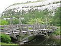
Living in DA9 9SU means inhabiting a compact, densely populated postcode in Kent’s Thames-side parish of Stone. The area covers just 4.5 hectares, yet it houses 1,548 residents, translating to a population density of 34,150 per square kilometre. This small cluster of homes is part of a historically significant settlement, once a Roman boundary town and later shaped by 19th-century cement industry growth. The area’s character is defined by its proximity to the River Thames, gravel soils, and remnants of ancient marshland. Daily life here is shaped by its proximity to Greenhithe and Dartford, with easy access to rail, ferry, and retail hubs. The community is predominantly middle-aged, with a median age of 47, and many residents own their homes. While the area lacks sprawling green spaces, its compact size ensures amenities are within walking or short driving distance, blending historical charm with modern connectivity.
- Area Type
- Postcode
- Area Size
- 4.5 hectares
- Population
- 1548
- Population Density
- 2194 people/km²
DA9 9SU’s property market is dominated by owner-occupied homes, with 66% of residents in private ownership. The accommodation type is exclusively houses, suggesting a mix of detached and semi-detached properties typical of smaller rural or semi-urban areas. Given the area’s compact size and high population density, the housing stock is likely limited, with little scope for new development. Buyers should consider that this small postcode is part of a broader parish with historical industrial sites, which may influence property values or desirability. The lack of rental data means it is unclear whether the area attracts investors or is primarily a family-owned market. For those seeking homes, proximity to transport links and amenities may outweigh the constraints of limited housing supply.
House Prices in DA9 9SU
No properties found in this postcode.
Energy Efficiency in DA9 9SU
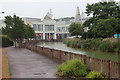
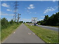
Daily life in DA9 9SU is shaped by its proximity to retail, transport, and waterfront access. The area’s nearest amenities include five retail outlets, such as Co-op Greenhithe and Waitrose Bluewater, though these are technically in adjacent areas. Rail services are plentiful, with five stations offering connections to London and beyond, while three ferry terminals provide Thames-crossing options. The historical setting of Stone, with its riverside location and industrial heritage, adds character to the area. However, the lack of named parks or leisure facilities within the postcode means residents may need to travel to nearby towns for green spaces or recreational activities. The compact layout ensures convenience, but the absence of detailed local amenities highlights the need to explore beyond DA9 9SU for a full range of services.
Amenities
Schools
The nearest school to DA9 9SU is Stone St Mary’s CofE Primary School, a primary school serving the local community. While the data lists this school twice, it is the sole named institution in the area. The absence of secondary schools or other educational institutions within the postcode means families may need to look beyond DA9 9SU for comprehensive schooling. This could be a consideration for those prioritising a full range of educational options. However, the presence of a primary school suggests some local provision for younger children, though parents may need to factor in commuting times for older students.
| Rank | School | Type | Entry gender | Ages |
|---|
Explore more schools in this area
Go to Schools tabDemographics
DA9 9SU’s population skews towards adults aged 30–64, with a median age of 47. Home ownership is strong, at 66%, and the majority of properties are houses, reflecting a community of established residents rather than transient renters. The predominant ethnic group is White, though no specific diversity statistics are provided. The high population density—34,150 per square kilometre—suggests a tightly packed residential cluster, which may influence local social dynamics and housing availability. The age profile indicates a stable, mature demographic, potentially with strong community ties and lower turnover. However, the absence of data on deprivation or household composition means the full picture of quality of life remains partially obscured.
Household Size
Accommodation Type
Tenure
Ethnic Group
Religion
Household Composition
Age
Household Deprivation
NS-SEC
Explore more demographic insights in this area
Go to Demographics tabPlanning
Planning Constraints
- Flood RiskPremium
- Ramsar Wetland SitesPremium
- Area of Outstanding Natural BeautyPremium
- Protected Nature ReservePremium
- Protected WoodlandPremium