Area Overview for DA9 9SB
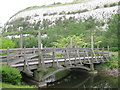
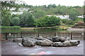
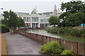
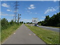
Photos of DA9 9SB


Area Information
DA9 9SB is a small, tightly knit postcode area in Kent, England, encompassing just 9.5 hectares and home to 2,190 residents. Its compact size means the community is closely connected, with a population density of 738 people per square kilometre. Nestled on the south bank of the River Thames, the area has a distinctive character shaped by its riverside location and historical roots. Stone, the parish it belongs to, has been inhabited for over a million years, with evidence of Palaeolithic tools and Roman settlements. Today, the area blends historical architecture—such as the medieval St Mary’s Church and Stone Castle—with modern infrastructure. Daily life here is influenced by its proximity to major transport routes, including the A2 and Watling Street, and its access to nearby towns like Greenhithe and Dartford. The area’s economy once thrived on cement production, though that industrial legacy now coexists with residential living. For those seeking a mix of history, convenience, and a quiet riverside setting, DA9 9SB offers a unique blend of small-town charm and practical connectivity.
- Area Type
- Postcode
- Area Size
- 9.5 hectares
- Population
- 2190
- Population Density
- 738 people/km²
The property market in DA9 9SB is characterised by a 56% home ownership rate, with flats being the dominant accommodation type. This suggests a housing stock tailored to smaller households or those prioritising ease of maintenance and location over larger properties. The prevalence of flats may indicate a rental market presence, though the exact proportion of rental units is not specified. Given the area’s compact size, property availability is limited, and buyers should consider nearby areas for more options. The focus on flats aligns with the needs of a mature demographic, where downsizing or low-maintenance living is common. However, the small postcode area means that property values and availability are closely tied to local amenities and transport links. For buyers, the challenge lies in balancing the benefits of proximity to the Thames and nearby towns with the constraints of a limited housing stock.
House Prices in DA9 9SB
No properties found in this postcode.
Energy Efficiency in DA9 9SB
Living in DA9 9SB offers access to a range of amenities within practical reach. Retail options include major chains like Waitrose Bluewater and M&S Bluewater, as well as M&S Dartford, providing shopping convenience. The area’s rail network, with stations such as Stone Crossing and Swanscombe, connects residents to broader regional services, while ferry terminals at Tilbury and West Street Pier offer alternative transport routes. The riverside location near the Thames adds to the area’s appeal, though specific parks or leisure facilities are not detailed in the data. The presence of historical sites like St Mary’s Church and Stone Castle adds cultural depth to daily life. For residents, the combination of retail, transport, and historical landmarks creates a lifestyle that balances practicality with a touch of heritage. The compact nature of the postcode means amenities are concentrated, reducing the need for long commutes but requiring careful planning for those with broader needs.
Amenities
Schools
| Rank | School | Type | Entry gender | Ages |
|---|
Explore more schools in this area
Go to Schools tabDemographics
The population of DA9 9SB is predominantly adults aged 30–64, with a median age of 47. This suggests a mature community, likely with established families and professionals. Home ownership rates are 56%, indicating a mix of owner-occupied properties and rental units. The area’s accommodation is largely flats, reflecting a housing stock suited to smaller households or those prioritising convenience over larger living spaces. The predominant ethnic group is White, though specific data on diversity is not provided. The population density of 738 people per square kilometre means the area is moderately crowded for its size, which could influence local amenities and social dynamics. While no data on deprivation is available, the high proportion of older residents may suggest a community with stable, long-term residents rather than transient populations. This demographic profile shapes a lifestyle focused on routine, familiarity, and proximity to essential services.
Household Size
Accommodation Type
Tenure
Ethnic Group
Religion
Household Composition
Age
Household Deprivation
NS-SEC
Explore more demographic insights in this area
Go to Demographics tabPlanning
Planning Constraints
- Flood RiskPremium
- Ramsar Wetland SitesPremium
- Area of Outstanding Natural BeautyPremium
- Protected Nature ReservePremium
- Protected WoodlandPremium