Area Overview for DA9 9PS
Photos of DA9 9PS
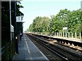
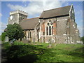
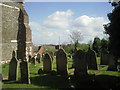
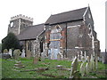
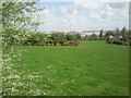
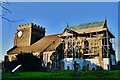
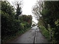
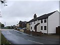
82 photos from this area
Area Information
Key information about the DA9 9PS including its size, population, and administrative classification.
- Area Type
- Postcode
- Area Size
- 2637 m²
- Population
- 2190
- Population Density
- 738 people/km²
House Prices in DA9 9PS
22
Properties
£141,414
Average Sold Price
£36,950
Lowest Price
£240,000
Highest Price
Showing 22 properties
| Address | Type | Beds | Baths | Last Sale Price | Last Sale Date | |
|---|---|---|---|---|---|---|
| 10 Chalice Way, Stone, DA9 9PS | Flat | 2 | 1 | £198,000 | Sep 2025 | |
| 14 Chalice Way, Stone, DA9 9PS | Flat | - | - | £200,000 | Oct 2024 | |
| 20 Chalice Way, Stone, DA9 9PS | Maisonette | 2 | 1 | £240,000 | Mar 2024 | |
| 32 Chalice Way, Stone, DA9 9PS | Flat | - | - | £165,000 | Oct 2023 | |
| 42 Chalice Way, Stone, DA9 9PS | Flat | - | 1 | £125,000 | Dec 2021 | |
| 2 Chalice Way, Stone, DA9 9PS | Flat | 2 | 1 | £200,000 | Nov 2021 | |
| 8 Chalice Way, Stone, DA9 9PS | Flat | - | - | £200,000 | Jun 2021 | |
| 6 Chalice Way, Stone, DA9 9PS | Flat | - | - | £185,000 | Jun 2021 | |
| 28 Chalice Way, Stone, DA9 9PS | Flat | - | - | £127,500 | Aug 2018 | |
| 24 Chalice Way, Stone, DA9 9PS | Flat | - | - | £108,000 | Jan 2016 |
Page 1 of 3
Energy Efficiency in DA9 9PS
Amenities
Schools
| Rank | School | Type | Entry gender | Ages |
|---|
Explore more schools in this area
Go to Schools tabDemographics
Household Size
One person
most common
Accommodation Type
Flats
most common
Tenure
56
majority
Ethnic Group
White
most common
Religion
N/A
most common
Household Composition
N/A
most common
Age
47
median
Adults (30-64 years)
most common
Household Deprivation
N/A
with no deprivation
NS-SEC
34
in Lower managerial occupations
Explore more demographic insights in this area
Go to Demographics tabPlanning
Planning Constraints
- Flood RiskPremium
- Ramsar Wetland SitesPremium
- Area of Outstanding Natural BeautyPremium
- Protected Nature ReservePremium
- Protected WoodlandPremium