Area Overview for DA9 9PP
Photos of DA9 9PP


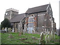


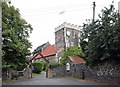


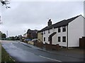
82 photos from this area
Area Information
Key information about the DA9 9PP including its size, population, and administrative classification.
- Area Type
- Postcode
- Area Size
- 2.1 hectares
- Population
- 2190
- Population Density
- 738 people/km²
House Prices in DA9 9PP
39
Properties
£131,942
Average Sold Price
£26,000
Lowest Price
£230,000
Highest Price
Showing 39 properties
| Address | Type | Beds | Baths | Last Sale Price | Last Sale Date | |
|---|---|---|---|---|---|---|
| 49 Cooper Close, Stone, DA9 9PP | Flat | 2 | 1 | £195,000 | Jul 2025 | |
| 75 Cooper Close, Stone, DA9 9PP | Flat | 1 | 1 | £162,500 | Jun 2025 | |
| 41 Cooper Close, Stone, DA9 9PP | Maisonette | 1 | 1 | £170,000 | Jun 2025 | |
| 77 Cooper Close, Stone, DA9 9PP | Flat | 1 | 1 | £175,000 | Feb 2023 | |
| 56 Cooper Close, Stone, DA9 9PP | Flat | - | - | £166,000 | Aug 2022 | |
| 48 Cooper Close, Stone, DA9 9PP | Flat | - | - | £230,000 | Feb 2022 | |
| 51 Cooper Close, Stone, DA9 9PP | Flat | - | - | £210,000 | Sep 2021 | |
| 69 Cooper Close, Stone, DA9 9PP | Flat | 1 | 1 | £163,500 | May 2020 | |
| 42 Cooper Close, Stone, DA9 9PP | Maisonette | 1 | 1 | £178,000 | Nov 2019 | |
| 55 Cooper Close, Stone, DA9 9PP | Flat | - | - | £160,000 | Sep 2019 |
Page 1 of 4
Energy Efficiency in DA9 9PP
Amenities
Schools
| Rank | School | Type | Entry gender | Ages |
|---|
Explore more schools in this area
Go to Schools tabDemographics
Household Size
One person
most common
Accommodation Type
Flats
most common
Tenure
56
majority
Ethnic Group
White
most common
Religion
N/A
most common
Household Composition
N/A
most common
Age
47
median
Adults (30-64 years)
most common
Household Deprivation
N/A
with no deprivation
NS-SEC
34
in Lower managerial occupations
Explore more demographic insights in this area
Go to Demographics tabPlanning
Planning Constraints
- Flood RiskPremium
- Ramsar Wetland SitesPremium
- Area of Outstanding Natural BeautyPremium
- Protected Nature ReservePremium
- Protected WoodlandPremium