Area Overview for DA9 9LU
Photos of DA9 9LU
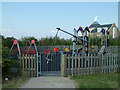
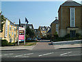
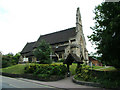

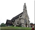
69 photos from this area
Area Information
Key information about the DA9 9LU including its size, population, and administrative classification.
- Area Type
- Postcode
- Area Size
- 2.5 hectares
- Population
- 1728
- Population Density
- 5071 people/km²
House Prices in DA9 9LU
69
Properties
£263,401
Average Sold Price
£73,000
Lowest Price
£525,000
Highest Price
Showing 69 properties
| Address | Type | Beds | Baths | Last Sale Price | Last Sale Date | |
|---|---|---|---|---|---|---|
| 14 Valley View, Greenhithe, DA9 9LU | Semi-detached | 3 | 1 | £365,000 | Aug 2025 | |
| 38 Valley View, Greenhithe, DA9 9LU | Terraced | 3 | 1 | £318,000 | May 2025 | |
| 64 Valley View, Greenhithe, DA9 9LU | house | 3 | 1 | £368,000 | Mar 2024 | |
| 34A Valley View, Greenhithe, DA9 9LU | Terraced | 3 | 1 | £525,000 | Sep 2023 | |
| 61 Valley View, Greenhithe, DA9 9LU | Terraced | 3 | 2 | £345,000 | Jun 2023 | |
| 23 Valley View, Greenhithe, DA9 9LU | Terraced | 3 | 1 | £350,000 | May 2023 | |
| 21 Valley View, Greenhithe, DA9 9LU | Terraced | 3 | 1 | £390,000 | Oct 2022 | |
| 41 Valley View, Greenhithe, DA9 9LU | Retail | 3 | 1 | £362,000 | Jun 2022 | |
| 39 Valley View, Greenhithe, DA9 9LU | house | - | - | £360,000 | Nov 2021 | |
| 17 Valley View, Greenhithe, DA9 9LU | Terraced | 3 | 1 | £350,000 | Sep 2021 |
Page 1 of 7
Energy Efficiency in DA9 9LU
Amenities
Schools
| Rank | School | Type | Entry gender | Ages |
|---|
Explore more schools in this area
Go to Schools tabDemographics
Household Size
Family (3-5 people)
most common
Accommodation Type
Houses
most common
Tenure
75
majority
Ethnic Group
White
most common
Religion
N/A
most common
Household Composition
N/A
most common
Age
47
median
Adults (30-64 years)
most common
Household Deprivation
N/A
with no deprivation
NS-SEC
35
in Lower managerial occupations
Explore more demographic insights in this area
Go to Demographics tabPlanning
Planning Constraints
- Flood RiskPremium
- Ramsar Wetland SitesPremium
- Area of Outstanding Natural BeautyPremium
- Protected Nature ReservePremium
- Protected WoodlandPremium