Area Overview for DA4 0DB
Photos of DA4 0DB
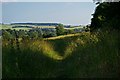
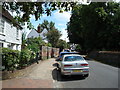
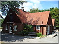
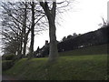
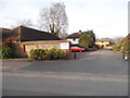
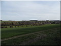
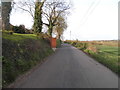
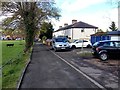
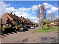
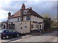
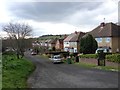
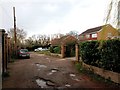
55 photos from this area
Area Information
Key information about the DA4 0DB including its size, population, and administrative classification.
- Area Type
- Postcode
- Area Size
- 5848 m²
- Population
- 1458
- Population Density
- 151 people/km²
House Prices in DA4 0DB
16
Properties
£362,864
Average Sold Price
£92,000
Lowest Price
£865,000
Highest Price
Showing 16 properties
| Address | Type | Beds | Baths | Last Sale Price | Last Sale Date | |
|---|---|---|---|---|---|---|
| 49 High Street, Farningham, DA4 0DB | Terraced | 2 | 1 | £320,000 | Mar 2025 | |
| 48 High Street, Farningham, DA4 0DB | Terraced | 3 | 1 | £285,000 | Nov 2020 | |
| Crossways, High Street, Farningham, DA4 0DB | house | - | - | £510,000 | Sep 2020 | |
| 47 High Street, Farningham, DA4 0DB | Terraced | 3 | - | £335,000 | Nov 2019 | |
| 50-51 High Street, Farningham, DA4 0DB | Detached | 4 | 1 | £475,000 | Nov 2017 | |
| 56 High Street, Farningham, DA4 0DB | Terraced | 4 | 1 | £405,000 | Mar 2014 | |
| Vale Cottage, 55 High Street, Farningham, DA4 0DB | house | - | - | £235,000 | Dec 2009 | |
| Pinehurst, High Street, Farningham, DA4 0DB | Detached | - | - | £865,000 | Aug 2006 | |
| White Gables, High Street, Farningham, DA4 0DB | Detached | 4 | 3 | £320,000 | Apr 2001 | |
| Forge Cottage, 57 High Street, Farningham, DA4 0DB | Terraced | 2 | 1 | £149,500 | May 1999 |
Page 1 of 2
Energy Efficiency in DA4 0DB
Amenities
Schools
| Rank | School | Type | Entry gender | Ages |
|---|
Explore more schools in this area
Go to Schools tabDemographics
Household Size
Family (3-5 people)
most common
Accommodation Type
Houses
most common
Tenure
78
majority
Ethnic Group
White
most common
Religion
N/A
most common
Household Composition
N/A
most common
Age
47
median
Adults (30-64 years)
most common
Household Deprivation
N/A
with no deprivation
NS-SEC
44
in Lower managerial occupations
Explore more demographic insights in this area
Go to Demographics tabPlanning
Planning Constraints
- Flood RiskPremium
- Ramsar Wetland SitesPremium
- Area of Outstanding Natural BeautyPremium
- Protected Nature ReservePremium
- Protected WoodlandPremium