Area Overview for DA3 7QH
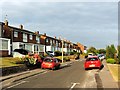
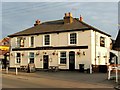
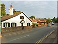
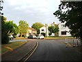
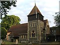
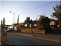
Photos of DA3 7QH


Area Information
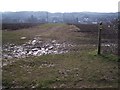
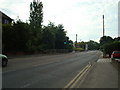
DA3 7QH is a small, tightly packed residential postcode in the heart of Longfield and New Barn, Kent. Covering just 599 square metres, it serves a population of 2034 people, creating a dense but manageable community. The area blends suburban convenience with rural character, nestled between the ancient village of Longfield and the newer residential developments of New Barn. Longfield, with its historic roots dating back to Saxon times, offers a quiet, low-density feel, while New Barn’s compact layout sits on a hill surrounded by open farmland. This mix of old and new creates a unique living environment, with easy access to nearby towns like Dartford and Meopham. The area’s proximity to major roads and rail lines ensures connectivity without sacrificing the charm of a smaller settlement. Residents benefit from a mix of local amenities, including schools, shops, and transport links, all within practical reach. The postcode’s small size means it’s a self-contained community, yet its location ensures it remains integrated with the broader South East England network.
- Area Type
- Postcode
- Area Size
- 599 m²
- Population
- 2034
- Population Density
- 1235 people/km²
The property market in DA3 7QH is dominated by owner-occupied homes, with 78% of properties owned by their residents. This high ownership rate suggests a stable, long-term community with limited rental activity. The accommodation type is exclusively houses, which is uncommon in more densely populated areas. This indicates a preference for larger, standalone properties, likely appealing to families or individuals seeking space. Given the postcode’s small size, the housing stock is limited, and the immediate surroundings may offer similar options in nearby villages like Longfield and New Barn. For buyers, this means a niche market with fewer choices but potentially higher demand from those prioritising privacy and property ownership. The absence of flats or apartments also means the area caters to those who prefer traditional housing over modern developments.
House Prices in DA3 7QH
No properties found in this postcode.
Energy Efficiency in DA3 7QH
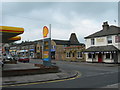
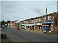
Residents of DA3 7QH have access to a range of amenities within practical reach. The area includes five retail outlets, such as Co-op Longfield, Waitrose Longfield, and Morrisons Daily, providing everyday shopping needs. Rail stations like Longfield Railway Station and Meopham Railway Station offer easy access to nearby towns, while ferry terminals like West Street Pier and Tilbury Ferry Terminal provide alternative transport options. The area’s character is defined by its mix of suburban convenience and rural tranquillity, with New Barn’s compact development surrounded by open farmland. This blend allows residents to enjoy local shops and transport links while retaining the peacefulness of a smaller settlement. The presence of multiple retail and transport hubs ensures a lifestyle that balances practicality with a relaxed, community-oriented environment.
Amenities
Schools
Residents of DA3 7QH have access to two notable schools. Axton Chase School is a primary institution, providing education for younger children. Nearby, Longfield Academy is an academy with an Ofsted rating of “good,” offering secondary education. The combination of a primary and secondary school within close proximity makes the area appealing to families seeking a seamless educational pathway. Longfield Academy’s “good” rating suggests a reliable standard of teaching and facilities, which is crucial for parents prioritising quality education. The presence of both school types reduces the need for long commutes, supporting a family-oriented lifestyle. While no data on pupil numbers or specific curricula is available, the availability of two schools indicates a well-served educational environment for the area’s population.
| Rank | School | Type | Entry gender | Ages |
|---|
Explore more schools in this area
Go to Schools tabDemographics
DA3 7QH has a median age of 47, with the majority of residents falling into the 30-64 age range. This suggests a mature, stable population, likely composed of families and long-term residents. Home ownership is high at 78%, indicating a community of property owners rather than renters. The accommodation type is predominantly houses, reflecting a preference for standalone homes over flats or apartments. The predominant ethnic group is White, which aligns with the broader demographic patterns of the region. The population density of 1235 people per square kilometre means the area is neither sprawling nor overly congested, offering a balance between space and community interaction. This density, combined with the age profile, suggests a mix of established households and professionals who value a settled, low-traffic environment. The data does not indicate significant deprivation, implying that residents generally have access to essential services and infrastructure.
Household Size
Accommodation Type
Tenure
Ethnic Group
Religion
Household Composition
Age
Household Deprivation
NS-SEC
Explore more demographic insights in this area
Go to Demographics tabPlanning
Planning Constraints
- Flood RiskPremium
- Ramsar Wetland SitesPremium
- Area of Outstanding Natural BeautyPremium
- Protected Nature ReservePremium
- Protected WoodlandPremium