Area Overview for DA3 7QD
Photos of DA3 7QD
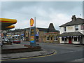
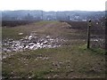
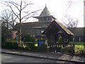
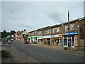
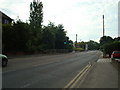
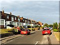
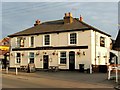
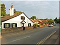

39 photos from this area
Area Information
Key information about the DA3 7QD including its size, population, and administrative classification.
- Area Type
- Postcode
- Area Size
- 2.3 hectares
- Population
- 2034
- Population Density
- 1235 people/km²
House Prices in DA3 7QD
36
Properties
£238,385
Average Sold Price
£83,000
Lowest Price
£425,000
Highest Price
Showing 36 properties
| Address | Type | Beds | Baths | Last Sale Price | Last Sale Date | |
|---|---|---|---|---|---|---|
| 41 Station Road, Longfield, DA3 7QD | house | 3 | 1 | £425,000 | Oct 2022 | |
| 43 Station Road, Longfield, DA3 7QD | house | 2 | 1 | £400,100 | Feb 2022 | |
| 50 Station Road, Longfield, DA3 7QD | house | - | - | £340,000 | Dec 2021 | |
| 54 Station Road, Longfield, DA3 7QD | house | 3 | - | £190,000 | Jun 2011 | |
| 44 Station Road, Longfield, DA3 7QD | Terraced | 3 | 1 | £200,000 | Oct 2006 | |
| 30 Station Road, Longfield, DA3 7QD | house | - | - | £225,000 | Feb 2003 | |
| 52 Station Road, Longfield, DA3 7QD | Terraced | 3 | 1 | £123,750 | Sep 2001 | |
| Care, 33A Station Road, Longfield, DA3 7QD | house | - | - | £275,000 | Mar 2001 | |
| 46 Station Road, Longfield, DA3 7QD | Terraced | - | - | £122,000 | Sep 2000 | |
| 48 Station Road, Longfield, DA3 7QD | Semi-detached | - | - | £83,000 | Aug 1997 |
Page 1 of 4
Energy Efficiency in DA3 7QD
Amenities
Schools
| Rank | School | Type | Entry gender | Ages |
|---|
Explore more schools in this area
Go to Schools tabDemographics
Household Size
Family (3-5 people)
most common
Accommodation Type
Houses
most common
Tenure
78
majority
Ethnic Group
White
most common
Religion
N/A
most common
Household Composition
N/A
most common
Age
47
median
Adults (30-64 years)
most common
Household Deprivation
N/A
with no deprivation
NS-SEC
39
in Lower managerial occupations
Explore more demographic insights in this area
Go to Demographics tabPlanning
Planning Constraints
- Flood RiskPremium
- Ramsar Wetland SitesPremium
- Area of Outstanding Natural BeautyPremium
- Protected Nature ReservePremium
- Protected WoodlandPremium