Area Overview for DA13 9AY
Photos of DA13 9AY
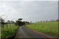
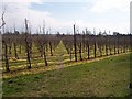
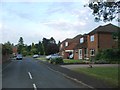
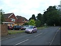
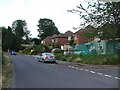
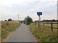
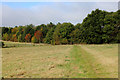
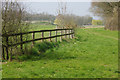
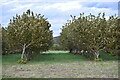
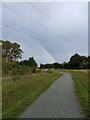
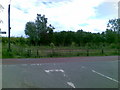
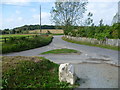
22 photos from this area
Area Information
Key information about the DA13 9AY including its size, population, and administrative classification.
- Area Type
- Postcode
- Area Size
- 36.3 hectares
- Population
- 1483
- Population Density
- 129 people/km²
House Prices in DA13 9AY
22
Properties
£564,433
Average Sold Price
£60,000
Lowest Price
£1,050,000
Highest Price
Showing 22 properties
| Address | Type | Beds | Baths | Last Sale Price | Last Sale Date | |
|---|---|---|---|---|---|---|
| Pinetop, Round Street, Cobham, Gravesend, DA13 9AY | Detached | 4 | 2 | £792,500 | Aug 2025 | |
| Sunny Side, Round Street, Cobham, Gravesend, DA13 9AY | house | - | - | £545,000 | Feb 2025 | |
| Eden Cottage, Round Street, Cobham, Gravesend, DA13 9AY | house | 4 | 2 | £1,050,000 | Aug 2023 | |
| Trelights, Round Street, Cobham, Gravesend, DA13 9AY | house | - | - | £612,000 | May 2023 | |
| Heros Cottage, Round Street, Cobham, Gravesend, DA13 9AY | Land | 4 | 1 | £655,000 | Jun 2022 | |
| Heros Cottage, 2 Round Street, Cobham, Gravesend, DA13 9AY | Cottage | 3 | 1 | £655,000 | Jun 2022 | |
| 1, Gables Cottages, Round Street, Cobham, Gravesend, DA13 9AY | house | - | - | £500,000 | Sep 2020 | |
| Orchard Cottage, Round Street, Cobham, Gravesend, DA13 9AY | Semi-detached | 4 | 2 | £770,000 | Nov 2017 | |
| Wellfield, Round Street, Cobham, Gravesend, DA13 9AY | Detached | 4 | 2 | £575,000 | Jan 2017 | |
| Homeside, Round Street, Cobham, Gravesend, DA13 9AY | Semi-detached | 4 | 2 | £580,000 | Jan 2016 |
Page 1 of 3
Energy Efficiency in DA13 9AY
Amenities
Schools
| Rank | School | Type | Entry gender | Ages |
|---|
Explore more schools in this area
Go to Schools tabDemographics
Household Size
Two person
most common
Accommodation Type
Houses
most common
Tenure
78
majority
Ethnic Group
White
most common
Religion
N/A
most common
Household Composition
N/A
most common
Age
47
median
Adults (30-64 years)
most common
Household Deprivation
N/A
with no deprivation
NS-SEC
46
in Lower managerial occupations
Explore more demographic insights in this area
Go to Demographics tabPlanning
Planning Constraints
- Flood RiskPremium
- Ramsar Wetland SitesPremium
- Area of Outstanding Natural BeautyPremium
- Protected Nature ReservePremium
- Protected WoodlandPremium