Area Overview for DA13 9AX
Photos of DA13 9AX
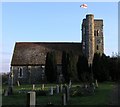
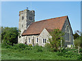
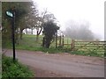
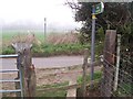
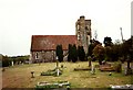
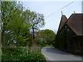
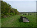
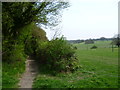


41 photos from this area
Area Information
Key information about the DA13 9AX including its size, population, and administrative classification.
- Area Type
- Postcode
- Area Size
- 40.5 hectares
- Population
- 1458
- Population Density
- 293 people/km²
House Prices in DA13 9AX
31
Properties
£475,972
Average Sold Price
£60,000
Lowest Price
£1,150,000
Highest Price
Showing 31 properties
| Address | Type | Beds | Baths | Last Sale Price | Last Sale Date | |
|---|---|---|---|---|---|---|
| Copper Beeches, White Post Lane, Cobham, Gravesend, DA13 9AX | house | - | - | £1,150,000 | Dec 2023 | |
| Finlarig, White Post Lane, Cobham, Gravesend, DA13 9AX | Semi-detached | 4 | 1 | £605,000 | Aug 2023 | |
| Three Links, White Post Lane, Cobham, Gravesend, DA13 9AX | Detached | 4 | 2 | £803,000 | Sep 2022 | |
| Meadow View, White Post Lane, Cobham, Gravesend, DA13 9AX | house | - | - | £802,000 | Jun 2022 | |
| Edendork, White Post Lane, Cobham, Gravesend, DA13 9AX | Detached | 4 | 2 | £545,000 | Dec 2018 | |
| Lille Norge, White Post Lane, Cobham, Gravesend, DA13 9AX | Detached | 4 | 1 | £495,000 | May 2014 | |
| Sandbanks, White Post Lane, Cobham, Gravesend, DA13 9AX | Detached | - | - | £433,000 | Mar 2014 | |
| Bluebells, White Post Lane, Cobham, Gravesend, DA13 9AX | house | - | - | £435,000 | Sep 2011 | |
| Elrosa, White Post Lane, Cobham, Gravesend, DA13 9AX | Detached | 3 | 2 | £295,000 | Apr 2009 | |
| Greenmount, White Post Lane, Cobham, Gravesend, DA13 9AX | Detached | - | - | £635,000 | Jul 2006 |
Page 1 of 4
Energy Efficiency in DA13 9AX
Amenities
Schools
| Rank | School | Type | Entry gender | Ages |
|---|
Explore more schools in this area
Go to Schools tabDemographics
Household Size
Two person
most common
Accommodation Type
Houses
most common
Tenure
87
majority
Ethnic Group
White
most common
Religion
N/A
most common
Household Composition
N/A
most common
Age
47
median
Adults (30-64 years)
most common
Household Deprivation
N/A
with no deprivation
NS-SEC
45
in Lower managerial occupations
Explore more demographic insights in this area
Go to Demographics tabPlanning
Planning Constraints
- Flood RiskPremium
- Ramsar Wetland SitesPremium
- Area of Outstanding Natural BeautyPremium
- Protected Nature ReservePremium
- Protected WoodlandPremium