Area Overview for DA12 2NW
Photos of DA12 2NW


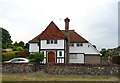
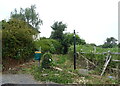
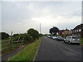
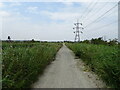

53 photos from this area
Area Information
Key information about the DA12 2NW including its size, population, and administrative classification.
- Area Type
- Postcode
- Area Size
- 6.7 hectares
- Population
- 2208
- Population Density
- 624 people/km²
House Prices in DA12 2NW
28
Properties
£290,975
Average Sold Price
£106,500
Lowest Price
£487,500
Highest Price
Showing 28 properties
| Address | Type | Beds | Baths | Last Sale Price | Last Sale Date | |
|---|---|---|---|---|---|---|
| 179 Lower Higham Road, Gravesend, DA12 2NW | house | 5 | - | £400,000 | Mar 2025 | |
| 191A Lower Higham Road, Gravesend, DA12 2NW | Bungalow | - | - | £385,000 | Jun 2021 | |
| 171 Lower Higham Road, Gravesend, DA12 2NW | Semi-detached | 4 | - | £467,000 | Sep 2020 | |
| 167 Lower Higham Road, Gravesend, DA12 2NW | Detached | 4 | 1 | £487,500 | Feb 2020 | |
| 147 Lower Higham Road, Gravesend, DA12 2NW | Semi-detached | 5 | 2 | £315,000 | Aug 2019 | |
| 153 Lower Higham Road, Gravesend, DA12 2NW | Semi-detached | 3 | 1 | £310,000 | May 2019 | |
| 165 Lower Higham Road, Gravesend, DA12 2NW | Semi-detached | 2 | 1 | £280,000 | Jun 2018 | |
| 155 Lower Higham Road, Gravesend, DA12 2NW | house | - | - | £355,000 | Nov 2017 | |
| 185 Lower Higham Road, Gravesend, DA12 2NW | Semi-detached | 3 | 2 | £270,000 | Oct 2015 | |
| 187 Lower Higham Road, Gravesend, DA12 2NW | Semi-detached | 3 | - | £300,000 | Sep 2015 |
Page 1 of 3
Energy Efficiency in DA12 2NW
Amenities
Schools
| Rank | School | Type | Entry gender | Ages |
|---|
Explore more schools in this area
Go to Schools tabDemographics
Household Size
Two person
most common
Accommodation Type
Houses
most common
Tenure
81
majority
Ethnic Group
White
most common
Religion
N/A
most common
Household Composition
N/A
most common
Age
47
median
Adults (30-64 years)
most common
Household Deprivation
N/A
with no deprivation
NS-SEC
31
in Lower managerial occupations
Explore more demographic insights in this area
Go to Demographics tabPlanning
Planning Constraints
- Flood RiskPremium
- Ramsar Wetland SitesPremium
- Area of Outstanding Natural BeautyPremium
- Protected Nature ReservePremium
- Protected WoodlandPremium