Area Overview for DA12 2NP
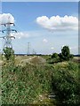
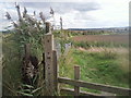
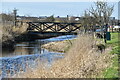
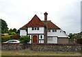
Photos of DA12 2NP


Area Information
Living in DA12 2NP places you within a specific residential cluster of just 27.2 hectares in Chalk, Kent. This small locality forms part of the Gravesham district and sits alongside the larger town of Gravesend. With a population of 2208 residents, the area maintains a quiet residential character while remaining close to local hubs. The postcode covers a tight community where space is defined by its compact footprint rather than sprawling development. You will find a village steeped in history, dating back to the Domesday Book, yet modernised with current infrastructure. The location balances rural heritage with practical access to wider transport networks. Daily life here is rooted in the local geography, offering a blend of historic charm and suburban convenience. The sense of place is solidified by its proximity to the east side of Gravesend without being part of the larger town's sprawling congestion. This specific postcode represents a distinct neighbourhood where residents enjoy a settled lifestyle. You benefit from being part of a defined residential area that has remained stable in character over time. The small size of the locality, coupled with its population density, ensures a tight-knit environment.
- Area Type
- Postcode
- Area Size
- 27.2 hectares
- Population
- 2208
- Population Density
- 624 people/km²
The housing stock in DA12 2NP is almost entirely composed of houses, distinguishing it from areas with larger concentrations of flats or apartments. With 81% of homes owner-occupied, this postcode is a stronghold of private ownership rather than rental properties. This high ownership percentage reflects the age of the area and the nature of the houses available within the 27.2-hectare cluster. You are unlikely to find purpose-built social housing or modern apartment blocks in this specific slice of Chalk. The market is driven by individual family homes suited to the local landscape and historical settlement patterns. Prospective buyers will find a space where most occupants have secured tenure over many years. The small size of the residential cluster limits large-scale development, ensuring the housing stock remains consistent with the village character. The dominance of houses and owner-occupiers indicates a stable market where previous residents have invested in their properties. This creates an environment where property values reflect long-term stability rather than speculative short-term rentals. Buyers seeking a traditional English village setting will find this postcode aligns with those expectations.
House Prices in DA12 2NP
Showing 29 properties
| Address | Type | Beds | Baths | Last Sale Price | Last Sale Date | |
|---|---|---|---|---|---|---|
| 239 Lower Higham Road, Gravesend, DA12 2NP | Bungalow | 3 | 1 | £400,000 | Aug 2025 | |
| 215 Lower Higham Road, Gravesend, DA12 2NP | Semi-detached | 3 | 1 | £450,000 | Sep 2024 | |
| 205 Lower Higham Road, Gravesend, DA12 2NP | Bungalow | 3 | 1 | £540,000 | Apr 2024 | |
| 211 Lower Higham Road, Gravesend, DA12 2NP | house | - | - | £570,000 | Dec 2021 | |
| 229 Lower Higham Road, Gravesend, DA12 2NP | Bungalow | - | - | £360,000 | Oct 2021 | |
| 209 Lower Higham Road, Gravesend, DA12 2NP | house | - | - | £505,000 | Jun 2021 | |
| 225 Lower Higham Road, Gravesend, DA12 2NP | house | 3 | - | £450,000 | Oct 2020 | |
| 221 Lower Higham Road, Gravesend, DA12 2NP | Bungalow | - | - | £357,500 | Sep 2020 | |
| 203 Lower Higham Road, Gravesend, DA12 2NP | Detached | 4 | - | £345,000 | Dec 2014 | |
| 237 Lower Higham Road, Gravesend, DA12 2NP | Bungalow | - | - | £220,000 | Dec 2012 |
Energy Efficiency in DA12 2NP
Residents of DA12 2NP enjoy convenient access to shops, transport links, and leisure options nearby. Three major supermarkets, Asda Chalk, Co-op Gravesend, and Tesco Valley, are within practical reach for regular shopping trips. For travel, you have access to three ferry terminals including Town Pier, West Street Pier, and Tilbury Ferry Terminal. Choice of rail is also strong with five stations nearby, such as Gravesend Railway Station, Higham Railway Station, and Tilbury Town Railway Station. These rail connections link you to Gravesend, Chatham, Northfleet, Dartford South, and Thurrock Central. The proximity to Gravesend allows you to access town centre amenities while living in the quieter village of Chalk. You can reach major railway hubs for London connections and regional travel with ease. The ferry terminals provide alternative transport routes across the Thames estuary. This mix of retail, rail, and ferry options creates a balanced lifestyle where daily needs and longer journeys are easily managed.
Amenities
Schools
Families moving to DA12 2NP have access to LINK19 College, located nearest to the postcode. This institution operates as a special school, catering to specific educational needs. It is currently the only school listed in the immediate vicinity of this residential cluster. The presence of a special school rather than primary or secondary institutions suggests that the local catchment area draws on services further away for compulsory education. You should verify the specific catchment zones for nearest mainstream schools if you require primary or secondary education for your children. The reliance on LINK19 College indicates a focus on specialized care within the local community. While LINK19 College serves a vital role, residents may need to look beyond this postcode for standard primary or secondary schooling options. The school mix in this immediate area points to a demographic where specialized education is a priority alongside standard schooling. Parents must research further to find mainstream schools that align with their children's curriculum needs.
| Rank | School | Type | Entry gender | Ages |
|---|
Explore more schools in this area
Go to Schools tabDemographics
The community in DA12 2NP is defined by a mature demographic profile with a median age of 47 years. The most common age range falls between 30 and 64 years, indicating a household dominated by adults rather than young families or elderly retirees alone. At 81%, home ownership rates are exceptionally high, meaning the vast majority of residents are mortgage-free or have settled finances. Houses make up the primary accommodation type, aligning with the older, established nature of the village. The population is predominantly White, reflecting the traditional character of the Kent village. With a population density of 624 people per square kilometre, the area is neither isolated nor overcrowded. This age profile and high ownership rate suggest a stable, long-term community where residents have put down deep roots. The absence of a significant student population or transient workforce is evident in these figures. You can expect a neighbourly atmosphere where longer-established families and professionals reside. The demographic data confirms a settled environment where residents rely on local services and community ties.
Household Size
Accommodation Type
Tenure
Ethnic Group
Religion
Household Composition
Age
Household Deprivation
NS-SEC
Explore more demographic insights in this area
Go to Demographics tabPlanning
Planning Constraints
- Flood RiskPremium
- Ramsar Wetland SitesPremium
- Area of Outstanding Natural BeautyPremium
- Protected Nature ReservePremium
- Protected WoodlandPremium