Area Overview for DA11 9JR
Photos of DA11 9JR


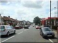


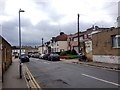
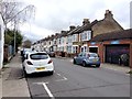
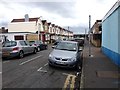
72 photos from this area
Area Information
Key information about the DA11 9JR including its size, population, and administrative classification.
- Area Type
- Postcode
- Area Size
- 7286 m²
- Population
- 1649
- Population Density
- 5385 people/km²
House Prices in DA11 9JR
30
Properties
£135,263
Average Sold Price
£18,000
Lowest Price
£317,000
Highest Price
Showing 30 properties
| Address | Type | Beds | Baths | Last Sale Price | Last Sale Date | |
|---|---|---|---|---|---|---|
| 31 London Road, Northfleet, Gravesend, DA11 9JR | Maisonette | 2 | 1 | £165,000 | Oct 2024 | |
| 45 London Road, Northfleet, Gravesend, DA11 9JR | Flat | - | - | £180,000 | Dec 2021 | |
| 39 London Road, Northfleet, Gravesend, DA11 9JR | Retail | 2 | 1 | £179,995 | Jul 2021 | |
| 51 London Road, Northfleet, Gravesend, DA11 9JR | Semi-detached | 4 | 2 | £317,000 | Jun 2021 | |
| 36 London Road, Northfleet, Gravesend, DA11 9JR | Flat | 2 | 1 | £175,000 | Oct 2017 | |
| 38 London Road, Northfleet, Gravesend, DA11 9JR | Maisonette | 2 | - | £185,000 | Jul 2017 | |
| 41 London Road, Northfleet, Gravesend, DA11 9JR | Flat | - | - | £148,000 | Mar 2017 | |
| 37 London Road, Northfleet, Gravesend, DA11 9JR | Maisonette | 2 | 1 | £134,000 | Feb 2017 | |
| 30 London Road, Northfleet, Gravesend, DA11 9JR | Maisonette | 1 | 1 | £134,500 | Jun 2015 | |
| 33 London Road, Northfleet, Gravesend, DA11 9JR | Maisonette | 2 | 1 | £127,000 | Oct 2014 |
Page 1 of 3
Energy Efficiency in DA11 9JR
Amenities
Schools
| Rank | School | Type | Entry gender | Ages |
|---|
Explore more schools in this area
Go to Schools tabDemographics
Household Size
Family (3-5 people)
most common
Accommodation Type
Houses
most common
Tenure
47
majority
Ethnic Group
White
most common
Religion
N/A
most common
Household Composition
N/A
most common
Age
47
median
Adults (30-64 years)
most common
Household Deprivation
N/A
with no deprivation
NS-SEC
20
in Lower managerial occupations
Explore more demographic insights in this area
Go to Demographics tabPlanning
Planning Constraints
- Flood RiskPremium
- Ramsar Wetland SitesPremium
- Area of Outstanding Natural BeautyPremium
- Protected Nature ReservePremium
- Protected WoodlandPremium