Area Overview for DA11 9JG
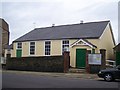
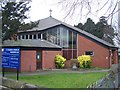
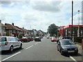
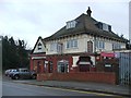
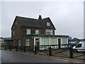
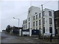
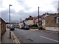
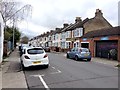
Photos of DA11 9JG


Area Information
Living in DA11 9JG means inhabiting a compact, high-density residential cluster in the Gravesham district of Kent. The area covers 2,737 square metres and is home to 1,649 people, creating a tightly knit community with a population density of over 600,000 per square kilometre. This postcode lies on the western edge of Gravesend, near the River Thames, with historical roots tracing back to the 1830s when Rosherville was developed as a new town by Jeremiah Rosher. The area’s character is shaped by its past as a site of Rosherville Gardens, a 19th-century pleasure ground that once attracted London day-trippers. Today, DA11 9JG blends residential living with proximity to transport hubs, including multiple railway stations and ferry terminals. Its small size means amenities are closely grouped, with shops, schools, and transport links within practical reach. While the area lacks natural landscapes, its strategic location near the Thames and major roads offers connectivity to broader Kent and London. Residents here are likely to value convenience, historical context, and the practicality of living in a place where daily needs are met within a short walk or drive.
- Area Type
- Postcode
- Area Size
- 2737 m²
- Population
- 1649
- Population Density
- 5385 people/km²
The property market in DA11 9JG is defined by a 47% home ownership rate, with houses making up the majority of accommodation types. This indicates a community where many residents are long-term homeowners, though the area is not dominated by owner-occupation, leaving a significant portion of the housing stock in rental hands. The small size of the postcode—just 2,737 square metres—means the housing stock is limited, with properties likely concentrated in a compact cluster. The prevalence of houses suggests a focus on single-family homes rather than high-density developments, which could appeal to buyers seeking traditional living spaces. However, the small area’s size may restrict property choices, with buyers needing to consider nearby suburbs or towns for more options. The mix of owner-occupied and rental properties also implies a dynamic market, where demand could be influenced by local employment opportunities and transport links.
House Prices in DA11 9JG
Showing 1 properties
| Address | Type | Beds | Baths | Last Sale Price | Last Sale Date | |
|---|---|---|---|---|---|---|
| Northfleet Garage, London Road, Northfleet, Gravesend, DA11 9JG | warehouse | - | - | - | - |
Energy Efficiency in DA11 9JG
Daily life in DA11 9JG is shaped by its proximity to retail, transport, and leisure options. The area has five retail outlets within reach, including Aldi Northfleet, Lidl Central, and Asda Gravesend, providing convenient shopping for groceries and essentials. Residents can access multiple railway stations and ferry terminals, enabling easy travel to nearby towns and cities. While the data does not mention parks or recreational spaces explicitly, the historical context of Rosherville—once a pleasure ground with gardens, a maze, and a pier—suggests potential for green spaces or heritage sites nearby. The compact nature of the area means amenities are closely grouped, reducing the need for long commutes. This concentration of services supports a practical, efficient lifestyle, with shopping, transport, and community hubs all within short distances. The blend of retail and transport options makes DA11 9JG appealing to those prioritising convenience and accessibility.
Amenities
Schools
The only school explicitly listed near DA11 9JG is Northfleet Nursery School, which provides early education for young children. No further details on its Ofsted rating or curriculum are provided in the data. The absence of primary or secondary schools in the immediate vicinity suggests that families may need to look beyond the postcode for comprehensive education options. This could be a consideration for prospective buyers prioritising proximity to schools. The presence of a nursery indicates some local provision for early years education, but parents may still need to rely on nearby schools in Northfleet or Gravesend for primary and secondary schooling. The lack of detailed school data means potential residents should investigate further to understand the full range of educational opportunities available to their children.
| Rank | School | Type | Entry gender | Ages |
|---|
Explore more schools in this area
Go to Schools tabDemographics
DA11 9JG has a median age of 47, with the majority of residents falling within the 30-64 age range. This suggests a mature, established community with a strong presence of middle-aged adults. Home ownership rates stand at 47%, indicating a mix of owner-occupied and rental properties, though not a predominantly rental market. The area is characterised by houses as the primary accommodation type, reflecting a preference for single-family living over flats or apartments. The predominant ethnic group is White, though no specific data on other demographics is provided. The population density—over 600,000 people per square kilometre—suggests a compact, possibly multi-generational living environment. This density may influence local services and infrastructure, with amenities tailored to a relatively small but concentrated population. The age profile and home ownership figures suggest a community that is stable but not without challenges, such as potential pressure on local services and housing availability in a small area.
Household Size
Accommodation Type
Tenure
Ethnic Group
Religion
Household Composition
Age
Household Deprivation
NS-SEC
Explore more demographic insights in this area
Go to Demographics tabPlanning
Planning Constraints
- Flood RiskPremium
- Ramsar Wetland SitesPremium
- Area of Outstanding Natural BeautyPremium
- Protected Nature ReservePremium
- Protected WoodlandPremium