Area Overview for DA10 1AP
Photos of DA10 1AP

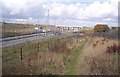

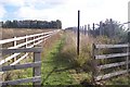
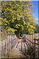
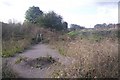


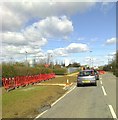

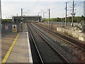
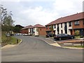
34 photos from this area
Area Information
Key information about the DA10 1AP including its size, population, and administrative classification.
- Area Type
- Postcode
- Area Size
- 3912 m²
- Population
- 1914
- Population Density
- 3947 people/km²
House Prices in DA10 1AP
24
Properties
£245,945
Average Sold Price
£203,000
Lowest Price
£280,000
Highest Price
Showing 24 properties
| Address | Type | Beds | Baths | Last Sale Price | Last Sale Date | |
|---|---|---|---|---|---|---|
| 1, Saltwood House, Candy Dene, Weldon, Ebbsfleet Valley, DA10 1AP | Flat | - | - | £265,000 | Jul 2024 | |
| 17, Saltwood House, Candy Dene, Weldon, Ebbsfleet Valley, DA10 1AP | Flat | - | - | £203,000 | May 2024 | |
| 2, Saltwood House, Candy Dene, Weldon, Ebbsfleet Valley, DA10 1AP | Flat | - | - | £220,000 | Jun 2021 | |
| 7, Saltwood House, Candy Dene, Weldon, Ebbsfleet Valley, DA10 1AP | Flat | - | - | £259,250 | Jun 2021 | |
| 8, Saltwood House, Candy Dene, Weldon, Ebbsfleet Valley, DA10 1AP | Flat | 1 | 1 | £230,000 | May 2021 | |
| 5, Saltwood House, Candy Dene, Weldon, Ebbsfleet Valley, DA10 1AP | Flat | - | - | £225,000 | May 2021 | |
| 9, Saltwood House, Candy Dene, Weldon, Ebbsfleet Valley, DA10 1AP | Flat | - | - | £222,500 | Feb 2021 | |
| 19, Saltwood House, Candy Dene, Weldon, Ebbsfleet Valley, DA10 1AP | Flat | 2 | 2 | £280,000 | Jan 2021 | |
| 21, Saltwood House, Candy Dene, Weldon, Ebbsfleet Valley, DA10 1AP | Flat | 1 | 1 | £228,000 | Dec 2020 | |
| 3, Saltwood House, Candy Dene, Weldon, Ebbsfleet Valley, DA10 1AP | Flat | - | - | £218,000 | Sep 2020 |
Page 1 of 3
Energy Efficiency in DA10 1AP
Amenities
Schools
| Rank | School | Type | Entry gender | Ages |
|---|
Explore more schools in this area
Go to Schools tabDemographics
Household Size
Family (3-5 people)
most common
Accommodation Type
Houses
most common
Tenure
80
majority
Ethnic Group
White
most common
Religion
N/A
most common
Household Composition
N/A
most common
Age
47
median
Adults (30-64 years)
most common
Household Deprivation
N/A
with no deprivation
NS-SEC
54
in Lower managerial occupations
Explore more demographic insights in this area
Go to Demographics tabPlanning
Planning Constraints
- Flood RiskPremium
- Ramsar Wetland SitesPremium
- Area of Outstanding Natural BeautyPremium
- Protected Nature ReservePremium
- Protected WoodlandPremium