Area Overview for DA10 1AU
Photos of DA10 1AU

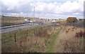
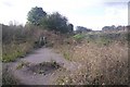


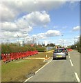

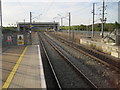
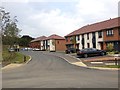
34 photos from this area
Area Information
Key information about the DA10 1AU including its size, population, and administrative classification.
- Area Type
- Postcode
- Area Size
- 5356 m²
- Population
- 1914
- Population Density
- 3947 people/km²
House Prices in DA10 1AU
26
Properties
£255,088
Average Sold Price
£79,500
Lowest Price
£545,000
Highest Price
Showing 26 properties
| Address | Type | Beds | Baths | Last Sale Price | Last Sale Date | |
|---|---|---|---|---|---|---|
| 9 Hildefirth Close, Weldon, Ebbsfleet Valley, DA10 1AU | Flat | 2 | 1 | £101,500 | Mar 2025 | |
| 24 Hildefirth Close, Weldon, Ebbsfleet Valley, DA10 1AU | Semi-detached | 3 | 2 | £450,000 | Jan 2025 | |
| 13 Hildefirth Close, Weldon, Ebbsfleet Valley, DA10 1AU | Flat | - | - | £87,000 | Mar 2024 | |
| 16 Hildefirth Close, Weldon, Ebbsfleet Valley, DA10 1AU | Flat | - | - | £88,200 | Jan 2023 | |
| 20 Hildefirth Close, Weldon, Ebbsfleet Valley, DA10 1AU | Flat | - | - | £81,000 | Nov 2022 | |
| 4 Hildefirth Close, Weldon, Ebbsfleet Valley, DA10 1AU | Detached | 4 | 2 | £545,000 | Jan 2021 | |
| 5 Hildefirth Close, Weldon, Ebbsfleet Valley, DA10 1AU | Flat | - | - | £79,500 | Feb 2020 | |
| 10 Hildefirth Close, Weldon, Ebbsfleet Valley, DA10 1AU | Flat | - | - | £135,000 | Dec 2018 | |
| 11 Hildefirth Close, Weldon, Ebbsfleet Valley, DA10 1AU | Flat | - | - | £81,000 | Sep 2018 | |
| 8 Hildefirth Close, Weldon, Ebbsfleet Valley, DA10 1AU | Flat | - | - | £135,000 | Aug 2018 |
Page 1 of 3
Energy Efficiency in DA10 1AU
Amenities
Schools
| Rank | School | Type | Entry gender | Ages |
|---|
Explore more schools in this area
Go to Schools tabDemographics
Household Size
Family (3-5 people)
most common
Accommodation Type
Houses
most common
Tenure
80
majority
Ethnic Group
White
most common
Religion
N/A
most common
Household Composition
N/A
most common
Age
47
median
Adults (30-64 years)
most common
Household Deprivation
N/A
with no deprivation
NS-SEC
54
in Lower managerial occupations
Explore more demographic insights in this area
Go to Demographics tabPlanning
Planning Constraints
- Flood RiskPremium
- Ramsar Wetland SitesPremium
- Area of Outstanding Natural BeautyPremium
- Protected Nature ReservePremium
- Protected WoodlandPremium