Area Overview for DA1 2JD
Photos of DA1 2JD
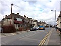
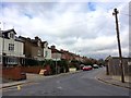
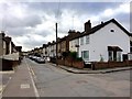
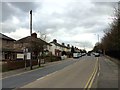
52 photos from this area
Area Information
Key information about the DA1 2JD including its size, population, and administrative classification.
- Area Type
- Postcode
- Area Size
- 1.2 hectares
- Population
- Not available
- Population Density
- Not available
House Prices in DA1 2JD
36
Properties
£294,281
Average Sold Price
£158,000
Lowest Price
£460,000
Highest Price
Showing 36 properties
| Address | Type | Beds | Baths | Last Sale Price | Last Sale Date | |
|---|---|---|---|---|---|---|
| 13 Vaughan Close, Dartford, DA1 2JD | Detached | 3 | 2 | £455,000 | Oct 2025 | |
| 35 Vaughan Close, Dartford, DA1 2JD | Terraced | 2 | 1 | £360,000 | Nov 2022 | |
| 2 Vaughan Close, Dartford, DA1 2JD | Terraced | 2 | 1 | £336,000 | Mar 2022 | |
| 20 Vaughan Close, Dartford, DA1 2JD | Flat | - | - | £235,000 | Aug 2020 | |
| 3 Vaughan Close, Dartford, DA1 2JD | Flat | 2 | 2 | £355,000 | Feb 2019 | |
| 36 Vaughan Close, Dartford, DA1 2JD | house | - | - | £342,500 | Oct 2018 | |
| 7 Vaughan Close, Dartford, DA1 2JD | Semi-detached | 5 | 2 | £460,000 | Jan 2018 | |
| 16 Vaughan Close, Dartford, DA1 2JD | Terraced | 3 | 3 | £330,000 | Sep 2017 | |
| 5 Vaughan Close, Dartford, DA1 2JD | Terraced | 2 | 1 | £305,000 | Jun 2017 | |
| 17 Vaughan Close, Dartford, DA1 2JD | Detached | 3 | 2 | £340,000 | May 2017 |
Page 1 of 4
Energy Efficiency in DA1 2JD
Amenities
Schools
| Rank | School | Type | Entry gender | Ages |
|---|
Explore more schools in this area
Go to Schools tabDemographics
Household Size
Family (3-5 people)
most common
Accommodation Type
Houses
most common
Tenure
68
majority
Ethnic Group
White
most common
Religion
N/A
most common
Household Composition
N/A
most common
Age
47
median
Adults (30-64 years)
most common
Household Deprivation
N/A
with no deprivation
NS-SEC
36
in Lower managerial occupations
Explore more demographic insights in this area
Go to Demographics tabPlanning
Planning Constraints
- Flood RiskPremium
- Ramsar Wetland SitesPremium
- Area of Outstanding Natural BeautyPremium
- Protected Nature ReservePremium
- Protected WoodlandPremium