Area Overview for DA1 2LG
Photos of DA1 2LG
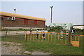
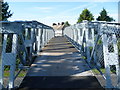
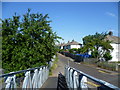
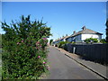
52 photos from this area
Area Information
Key information about the DA1 2LG including its size, population, and administrative classification.
- Area Type
- Postcode
- Area Size
- 7287 m²
- Population
- Not available
- Population Density
- Not available
House Prices in DA1 2LG
41
Properties
£205,490
Average Sold Price
£43,250
Lowest Price
£402,000
Highest Price
Showing 41 properties
| Address | Type | Beds | Baths | Last Sale Price | Last Sale Date | |
|---|---|---|---|---|---|---|
| 15 Gordon Road, Dartford, DA1 2LG | Terraced | 1 | 1 | £300,000 | Apr 2025 | |
| 77 Gordon Road, Dartford, DA1 2LG | Terraced | 3 | 1 | £332,000 | Aug 2024 | |
| 21 Gordon Road, Dartford, DA1 2LG | Terraced | 3 | 1 | £298,500 | May 2024 | |
| 85 Gordon Road, Dartford, DA1 2LG | house | - | - | £402,000 | Mar 2022 | |
| 55 Gordon Road, Dartford, DA1 2LG | Retail | 3 | 1 | £275,000 | Mar 2022 | |
| 13 Gordon Road, Dartford, DA1 2LG | house | - | - | £275,000 | Dec 2021 | |
| 49 Gordon Road, Dartford, DA1 2LG | Terraced | 2 | 1 | £292,000 | Jul 2021 | |
| 79 Gordon Road, Dartford, DA1 2LG | Terraced | 3 | 1 | £232,000 | Feb 2019 | |
| 41 Gordon Road, Dartford, DA1 2LG | Terraced | 3 | 1 | £285,000 | Sep 2018 | |
| 5 Gordon Road, Dartford, DA1 2LG | house | - | - | £235,000 | Sep 2016 |
Page 1 of 5
Energy Efficiency in DA1 2LG
Amenities
Schools
| Rank | School | Type | Entry gender | Ages |
|---|
Explore more schools in this area
Go to Schools tabDemographics
Household Size
One person
most common
Accommodation Type
Flats
most common
Tenure
39
majority
Ethnic Group
White
most common
Religion
N/A
most common
Household Composition
N/A
most common
Age
47
median
Adults (30-64 years)
most common
Household Deprivation
N/A
with no deprivation
NS-SEC
30
in Lower managerial occupations
Explore more demographic insights in this area
Go to Demographics tabPlanning
Planning Constraints
- Flood RiskPremium
- Ramsar Wetland SitesPremium
- Area of Outstanding Natural BeautyPremium
- Protected Nature ReservePremium
- Protected WoodlandPremium