Area Overview for DA1 1TL
Photos of DA1 1TL
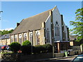
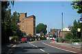
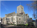
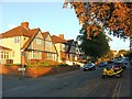
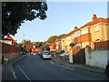
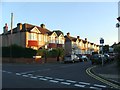
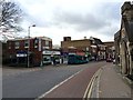
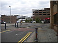
100 photos from this area
Area Information
Key information about the DA1 1TL including its size, population, and administrative classification.
- Area Type
- Postcode
- Area Size
- 1.1 hectares
- Population
- Not available
- Population Density
- Not available
House Prices in DA1 1TL
62
Properties
£211,080
Average Sold Price
£44,000
Lowest Price
£415,000
Highest Price
Showing 62 properties
| Address | Type | Beds | Baths | Last Sale Price | Last Sale Date | |
|---|---|---|---|---|---|---|
| 18 Little Queen Street, Dartford, DA1 1TL | Terraced | 3 | 1 | £360,000 | Aug 2025 | |
| 38 Little Queen Street, Dartford, DA1 1TL | house | - | - | £415,000 | May 2024 | |
| 57 Little Queen Street, Dartford, DA1 1TL | Terraced | 3 | 1 | £325,000 | Sep 2022 | |
| 22 Little Queen Street, Dartford, DA1 1TL | Retail | 3 | 1 | £390,000 | Jul 2022 | |
| 23 Little Queen Street, Dartford, DA1 1TL | Retail | 2 | 1 | £275,000 | May 2022 | |
| 66 Little Queen Street, Dartford, DA1 1TL | Terraced | 2 | 1 | £254,000 | May 2021 | |
| 60 Little Queen Street, Dartford, DA1 1TL | Terraced | 1 | - | £259,995 | Feb 2021 | |
| 30 Little Queen Street, Dartford, DA1 1TL | Semi-detached | 2 | 1 | £249,000 | Sep 2018 | |
| 49 Little Queen Street, Dartford, DA1 1TL | Terraced | 2 | 1 | £277,500 | Apr 2018 | |
| 53 Little Queen Street, Dartford, DA1 1TL | Semi-detached | 2 | 1 | £240,000 | Dec 2017 |
Page 1 of 7
Energy Efficiency in DA1 1TL
Amenities
Schools
| Rank | School | Type | Entry gender | Ages |
|---|
Explore more schools in this area
Go to Schools tabDemographics
Household Size
Family (3-5 people)
most common
Accommodation Type
Houses
most common
Tenure
55
majority
Ethnic Group
White
most common
Religion
N/A
most common
Household Composition
N/A
most common
Age
47
median
Adults (30-64 years)
most common
Household Deprivation
N/A
with no deprivation
NS-SEC
30
in Lower managerial occupations
Explore more demographic insights in this area
Go to Demographics tabPlanning
Planning Constraints
- Flood RiskPremium
- Ramsar Wetland SitesPremium
- Area of Outstanding Natural BeautyPremium
- Protected Nature ReservePremium
- Protected WoodlandPremium