Area Overview for DA1 1SW
Photos of DA1 1SW

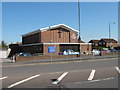

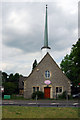
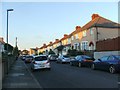
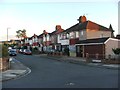
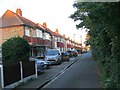
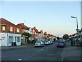
77 photos from this area
Area Information
Key information about the DA1 1SW including its size, population, and administrative classification.
- Area Type
- Postcode
- Area Size
- 7009 m²
- Population
- Not available
- Population Density
- Not available
House Prices in DA1 1SW
37
Properties
£231,618
Average Sold Price
£45,500
Lowest Price
£445,000
Highest Price
Showing 37 properties
| Address | Type | Beds | Baths | Last Sale Price | Last Sale Date | |
|---|---|---|---|---|---|---|
| 113 East Hill, Dartford, DA1 1SW | Terraced | 4 | 2 | £445,000 | Nov 2024 | |
| 107 East Hill, Dartford, DA1 1SW | Terraced | 3 | 1 | £410,000 | Aug 2024 | |
| 141 East Hill, Dartford, DA1 1SW | Terraced | 1 | 2 | £435,000 | Dec 2023 | |
| 147 East Hill, Dartford, DA1 1SW | Flat | - | - | £130,000 | Apr 2023 | |
| 143 East Hill, Dartford, DA1 1SW | Terraced | 3 | 1 | £335,000 | Feb 2022 | |
| 125 East Hill, Dartford, DA1 1SW | Semi-detached | 4 | 1 | £305,000 | Aug 2020 | |
| 139 East Hill, Dartford, DA1 1SW | Terraced | 4 | 1 | £325,000 | Mar 2020 | |
| 103 East Hill, Dartford, DA1 1SW | house | - | - | £207,250 | May 2019 | |
| 133 East Hill, Dartford, DA1 1SW | Terraced | 3 | 1 | £300,000 | May 2017 | |
| 137 East Hill, Dartford, DA1 1SW | Semi-detached | - | - | £235,000 | Apr 2007 |
Page 1 of 4
Energy Efficiency in DA1 1SW
Amenities
Schools
| Rank | School | Type | Entry gender | Ages |
|---|
Explore more schools in this area
Go to Schools tabDemographics
Household Size
Family (3-5 people)
most common
Accommodation Type
Houses
most common
Tenure
69
majority
Ethnic Group
White
most common
Religion
N/A
most common
Household Composition
N/A
most common
Age
47
median
Adults (30-64 years)
most common
Household Deprivation
N/A
with no deprivation
NS-SEC
36
in Lower managerial occupations
Explore more demographic insights in this area
Go to Demographics tabPlanning
Planning Constraints
- Flood RiskPremium
- Ramsar Wetland SitesPremium
- Area of Outstanding Natural BeautyPremium
- Protected Nature ReservePremium
- Protected WoodlandPremium