Area Overview for DA1 1BF
Photos of DA1 1BF
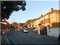
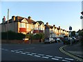
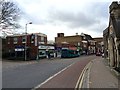
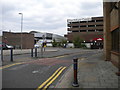
100 photos from this area
Area Information
Key information about the DA1 1BF including its size, population, and administrative classification.
- Area Type
- Postcode
- Area Size
- 2879 m²
- Population
- Not available
- Population Density
- Not available
House Prices in DA1 1BF
88
Properties
£305,255
Average Sold Price
£201,995
Lowest Price
£340,995
Highest Price
Showing 88 properties
| Address | Type | Beds | Baths | Last Sale Price | Last Sale Date | |
|---|---|---|---|---|---|---|
| 130 Brewers Square, Dartford, DA1 1BF | Flat | - | - | £329,995 | Oct 2023 | |
| 138 Brewers Square, Dartford, DA1 1BF | Flat | - | - | £256,995 | Apr 2023 | |
| 175 Brewers Square, Dartford, DA1 1BF | Flat | - | - | £262,995 | Apr 2023 | |
| 162 Brewers Square, Dartford, DA1 1BF | Flat | - | - | £258,995 | Mar 2023 | |
| 149 Brewers Square, Dartford, DA1 1BF | Flat | 2 | 1 | £251,995 | Mar 2023 | |
| 136 Brewers Square, Dartford, DA1 1BF | Flat | - | - | £256,995 | Mar 2023 | |
| 180 Brewers Square, Dartford, DA1 1BF | Flat | 1 | 1 | £328,995 | Mar 2023 | |
| 186 Brewers Square, Dartford, DA1 1BF | Flat | - | - | £330,995 | Mar 2023 | |
| 121 Brewers Square, Dartford, DA1 1BF | Flat | - | - | £264,995 | Mar 2023 | |
| 155 Brewers Square, Dartford, DA1 1BF | Flat | - | - | £330,995 | Feb 2023 |
Page 1 of 9
Energy Efficiency in DA1 1BF
Amenities
Schools
| Rank | School | Type | Entry gender | Ages |
|---|
Explore more schools in this area
Go to Schools tabDemographics
Household Size
One person
most common
Accommodation Type
Flats
most common
Tenure
39
majority
Ethnic Group
White
most common
Religion
N/A
most common
Household Composition
N/A
most common
Age
47
median
Adults (30-64 years)
most common
Household Deprivation
N/A
with no deprivation
NS-SEC
30
in Lower managerial occupations
Explore more demographic insights in this area
Go to Demographics tabPlanning
Planning Constraints
- Flood RiskPremium
- Ramsar Wetland SitesPremium
- Area of Outstanding Natural BeautyPremium
- Protected Nature ReservePremium
- Protected WoodlandPremium