Area Overview for DA1 1HB
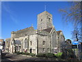
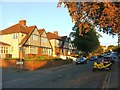
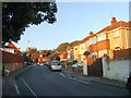
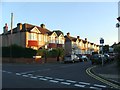
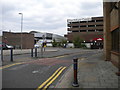
Photos of DA1 1HB


Area Information
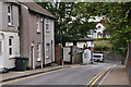
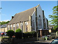
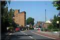
DA1 1HB is a small residential postcode area nestled in the northern part of Dartford, a town in north-west Kent. With a population of 1,812, it forms part of the broader Town Ward, which sits approximately 18 miles south-east of London. The area is defined by its compact cluster of homes, predominantly flats, and its proximity to the River Thames. Daily life here is shaped by its location: just a short distance from Dartford Railway Station, which links the area to London and surrounding towns. The postcode is part of an urban centre, with the town’s historic High Street and parish church nearby, though the ward itself is noted as one of Dartford’s more deprived areas. Residents benefit from nearby retail options, including Iceland, Sainsburys, and Aldi in Dartford, and rail access to major hubs. While the area lacks large-scale amenities, its compact nature makes it practical for those prioritising connectivity over sprawling spaces. Living in DA1 1HB means navigating a balance between urban convenience and the challenges of a smaller, tightly knit community.
- Area Type
- Postcode
- Area Size
- Not available
- Population
- Not available
- Population Density
- Not available
The property market in DA1 1HB is defined by its high proportion of rental homes and flat-based housing. With only 39% of properties owner-occupied, the area leans heavily towards a rental market, which may appeal to those seeking short-term or flexible living arrangements. Flats dominate the accommodation type, a reflection of Dartford’s urban planning and the compact nature of the postcode. This configuration suits buyers looking for affordable, manageable spaces but may limit options for those seeking larger or detached properties. The small size of DA1 1HB means the immediate surroundings are critical for property seekers, with nearby areas offering more variety. For buyers prioritising ownership, the low home ownership rate and flat-centric stock suggest a need to explore adjacent postcode areas for greater choice. The market’s character is shaped by its role within Dartford’s broader urban fabric, where property values and availability are influenced by proximity to transport links and local amenities.
House Prices in DA1 1HB
No properties found in this postcode.
Energy Efficiency in DA1 1HB
The lifestyle in DA1 1HB is shaped by its proximity to Dartford’s retail and transport hubs. Within practical reach are major supermarkets like Iceland, Sainsburys, and Aldi, providing convenience for shopping and daily essentials. The rail network, with stations such as Dartford and Crayford, offers easy access to London and surrounding areas, supporting both commuter and leisure travel. While the area itself lacks large parks or leisure facilities, the broader Dartford Town area includes Central Park and the Orchard Theatre, though these are not explicitly tied to DA1 1HB. The compact nature of the postcode means residents must venture slightly beyond the area for cultural or recreational activities. Nonetheless, the combination of retail accessibility and rail connectivity ensures a functional lifestyle for those prioritising practicality over expansive amenities.
Amenities
Schools
The primary school nearest to DA1 1HB is Westgate Primary School, which serves the area with a good Ofsted rating. This school is one of the notable educational institutions in the broader Dartford Town area, though the data does not list secondary schools within the postcode. The presence of a well-rated primary school is a key consideration for families, offering a foundation for early education. However, families requiring secondary schooling may need to look beyond DA1 1HB, as the area’s small size limits the range of schools available. The school’s rating indicates a focus on quality education, but the lack of additional schools nearby means proximity to other educational institutions is a practical concern for parents. This dynamic underscores the importance of assessing broader regional options when considering the area for long-term family living.
| Rank | School | Type | Entry gender | Ages |
|---|
Explore more schools in this area
Go to Schools tabDemographics
DA1 1HB has a median age of 47, with the majority of residents aged between 30 and 64. This reflects a mature, working-age population, though the area’s 39% home ownership rate suggests a significant proportion of households are renters. The accommodation type is predominantly flats, a common feature in Dartford’s urban centres. The predominant ethnic group is White, though the broader Dartford Town area includes 32.6% ethnic minority residents. The 2021 Census highlights that 65% of dwellings in the wider area are owner-occupied, but this figure drops to 39% in DA1 1HB, indicating a higher reliance on rental housing. This dynamic may influence the area’s character, with a mix of long-term residents and transient tenants. The demographic profile suggests a community focused on stability, but the ward’s status as one of Dartford’s most deprived areas may impact access to services and opportunities.
Household Size
Accommodation Type
Tenure
Ethnic Group
Religion
Household Composition
Age
Household Deprivation
NS-SEC
Explore more demographic insights in this area
Go to Demographics tabPlanning
Planning Constraints
- Flood RiskPremium
- Ramsar Wetland SitesPremium
- Area of Outstanding Natural BeautyPremium
- Protected Nature ReservePremium
- Protected WoodlandPremium