Area Overview for CT1 2DS
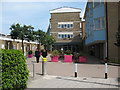
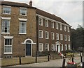
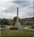
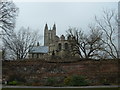
Photos of CT1 2DS
Area Information
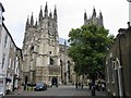
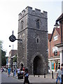
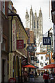
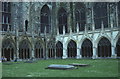
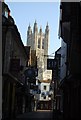
Living in CT1 2DS means inhabiting a compact, high-density residential cluster within Canterbury’s historic heart. The area spans just 2,299 m², housing 1,295 people—a population density of 563,355 per km², reflecting its small, closely knit character. This postcode is defined by its proximity to the Westgate, Canterbury’s iconic medieval city gate, a Grade I listed structure that once served as a defensive stronghold and prison. The area’s historical roots are palpable, with the Westgate’s drum towers, gun loops, and vaulted passageways standing as a testament to the city’s medieval past. Modern life here blends with heritage, offering residents a unique mix of historical intrigue and contemporary convenience. With a median age of 22 and a population dominated by young adults, the area thrives on a dynamic, youthful energy. Its location near Canterbury’s central landmarks and transport hubs makes it ideal for those seeking a mix of history, accessibility, and community.
- Area Type
- Postcode
- Area Size
- 2299 m²
- Population
- Not available
- Population Density
- Not available
The property market in CT1 2DS is shaped by its small size and high density. With 44% of homes owned by residents, the area leans more towards rental than owner-occupied housing, though the accommodation type is predominantly houses. This suggests a mix of family homes, smaller properties, and perhaps some converted or historic buildings. The limited area size means the housing stock is constrained, which could drive competition for available properties. Buyers should consider the area’s proximity to Canterbury’s core, offering access to transport, schools, and amenities, but also its compact nature, which may limit private outdoor space. The presence of houses rather than flats or apartments indicates a focus on traditional, perhaps more spacious living, though the high population density suggests properties are likely to be smaller or shared.
House Prices in CT1 2DS
No properties found in this postcode.
Energy Efficiency in CT1 2DS
Residents of CT1 2DS enjoy a range of nearby amenities, including five retail outlets such as M&S Canterbury, Waitrose Canterbury, and Sainsburys Canterbury, ensuring easy access to shopping and daily essentials. The area’s proximity to Canterbury’s historic sites, like the Westgate, offers cultural and leisure opportunities, though specific parks or recreational spaces are not listed. The rail network provides seamless connections to surrounding areas, supporting both commuting and weekend travel. The compact layout means amenities are within walking or short driving distance, fostering a convenient lifestyle. While the data does not mention dining or leisure venues, the presence of major supermarkets and rail links suggests a practical, service-oriented environment. The blend of retail, transport, and historical sites creates a balanced, accessible community.
Amenities
Schools
Residents of CT1 2DS have access to two independent schools: The King’s School Canterbury and The Family School. Both are private institutions, offering alternatives to state education. The King’s School is a well-established independent school with a long history, while The Family School is likely a smaller, possibly specialist institution. The presence of two independent schools suggests a demand for private education in the area, though no Ofsted ratings are provided. Families seeking non-state schooling may find these options appealing, though the cost of private education is not specified. The absence of state schools in the data means the area’s educational landscape is focused on independent institutions, which may influence the community’s socioeconomic profile.
| Rank | School | Type | Entry gender | Ages |
|---|---|---|---|---|
| 1 | The King's School Canterbury | independent | N/A | N/A |
| 2 | The Family School | independent | N/A | N/A |
Explore more schools in this area
Go to Schools tabDemographics
CT1 2DS has a median age of 22, with the majority of residents aged 15–29. This youthful demographic shapes the area’s character, suggesting a focus on student life, early careers, or young families. Home ownership here is relatively low, at 44%, indicating a higher proportion of renters compared to owner-occupied properties. The accommodation type is predominantly houses, which is unusual for a small, high-density area, suggesting a mix of single-family homes and smaller dwellings. The predominant ethnic group is White, with no data provided on other groups. While the area’s young population may correlate with lower deprivation levels, the high population density and limited housing stock could influence local amenities and services. The absence of specific deprivation statistics means the quality of life is inferred from the area’s compact, historic layout and proximity to Canterbury’s resources.
Household Size
Accommodation Type
Tenure
Ethnic Group
Religion
Household Composition
Age
Household Deprivation
NS-SEC
Explore more demographic insights in this area
Go to Demographics tabPlanning
Planning Constraints
- Flood RiskPremium
- Ramsar Wetland SitesPremium
- Area of Outstanding Natural BeautyPremium
- Protected Nature ReservePremium
- Protected WoodlandPremium
- Crime RiskPremium