Area Overview for CT1 1NG
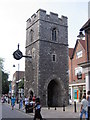
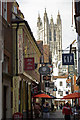
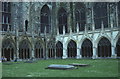
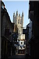
Photos of CT1 1NG
Area Information
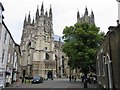
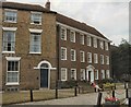
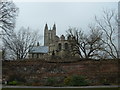
Living in CT1 1NG means being part of a tightly packed residential cluster within Canterbury’s historic heart. The area covers 4,559 m² and is home to 1,481 people, creating a high population density of 324,841 people per km². This postcode falls within Barton Ward, a historic electoral area near Canterbury’s UNESCO World Heritage Site. The proximity to medieval landmarks like Barton Hall and Jesus Hospital adds a layer of historical significance to daily life. Residents benefit from easy access to Canterbury’s cultural and educational hubs, including Canterbury Christ Church University. While the area is small, it is well-connected to nearby amenities, making it a practical choice for those seeking a compact, historic living environment without sacrificing convenience. The community’s young demographic, with a median age of 22, suggests a dynamic, possibly student-influenced atmosphere. However, the low home ownership rate (27%) indicates a rental-dominated market, which may shape the area’s transient character.
- Area Type
- Postcode
- Area Size
- 4559 m²
- Population
- 1481
- Population Density
- 5282 people/km²
The property market in CT1 1NG is characterised by a low home ownership rate (27%), suggesting a rental market dominated by tenants rather than homeowners. The accommodation type is primarily houses, which is unusual for an area of this size and density. This mix may reflect a blend of older, family homes and newer rental properties catering to students and young professionals. Given the area’s proximity to Canterbury Christ Church University, it is plausible that student rentals form a significant portion of the housing stock. Buyers considering CT1 1NG should note the limited housing stock and high demand, which may drive up rental prices. The small area size also means competition for available properties, making it a challenging market for those seeking long-term ownership.
House Prices in CT1 1NG
No properties found in this postcode.
Energy Efficiency in CT1 1NG
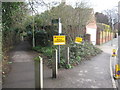
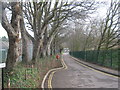
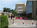
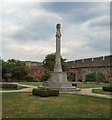
CT1 1NG offers a range of amenities within walking or short driving distance. Retail options include major stores like Waitrose Canterbury, M&S Canterbury, and Tesco Canterbury, providing convenience for shopping and daily essentials. The nearby rail stations connect residents to broader networks, enhancing accessibility to Canterbury’s cultural and commercial hubs. While the area’s small size limits green spaces, its proximity to historic sites like Barton Hall and Jesus Hospital adds character. The mix of retail, transport, and historical landmarks creates a lifestyle that balances practicality with heritage. However, the lack of detailed data on parks or leisure facilities means residents may need to travel further for recreational activities.
Amenities
Schools
Residents of CT1 1NG have access to Barton Court Grammar School, a primary school with an Ofsted rating of ‘good’, and an academy of the same name, which likely serves older children. Nearby, Canterbury Christ Church University offers higher education opportunities. The presence of both primary and higher education institutions makes the area appealing to families with children at different stages of their education. However, the lack of secondary schools in the immediate vicinity may require commuting for older students. The ‘good’ Ofsted rating at Barton Court Grammar School indicates a reliable primary education option, though parents should verify if the academy meets their specific needs.
| Rank | School | Type | Entry gender | Ages |
|---|---|---|---|---|
| 1 | Barton Court Grammar School | primary | N/A | N/A |
| 2 | Canterbury Christ Church University | other | N/A | N/A |
| 3 | Barton Court Grammar School | academy | N/A | N/A |
Explore more schools in this area
Go to Schools tabDemographics
CT1 1NG has a median age of 22, with the majority of residents aged 15–29. This young demographic skews the population toward students and early-career professionals, reflected in the 27% home ownership rate. Only 27% of households are owner-occupied, suggesting a rental-heavy market. The area’s accommodation is predominantly houses, though the high population density implies limited space for expansion. The predominant ethnic group is White, with no specific data on other demographics. The low home ownership and young age profile may indicate a transient community, possibly influenced by nearby universities and educational institutions. While the area’s compact size fosters close-knit interactions, the high density could impact living standards, particularly in shared spaces.
Household Size
Accommodation Type
Tenure
Ethnic Group
Religion
Household Composition
Age
Household Deprivation
NS-SEC
Explore more demographic insights in this area
Go to Demographics tabPlanning
Planning Constraints
- Flood RiskPremium
- Ramsar Wetland SitesPremium
- Area of Outstanding Natural BeautyPremium
- Protected Nature ReservePremium
- Protected WoodlandPremium
- Crime RiskPremium