Area Overview for CT1 1QH
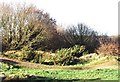
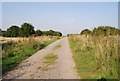
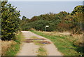
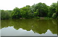
Photos of CT1 1QH

Area Information
CT1 1QH is a compact residential postcode area nestled within Canterbury, a historic city designated a UNESCO World Heritage Site. Covering just 3.3 hectares, it is densely populated, with 1,481 residents packed into a space that reflects the city’s medieval origins. The area is part of Barton Ward, a historic electoral district with ties to landmarks like Barton Hall, once linked to the Culpeper family. Daily life here is shaped by proximity to Canterbury’s cultural and educational hubs, including Canterbury Christ Church University. The young demographic—median age 22—suggests a community of students, professionals, and young families, with a vibrant mix of local amenities and transport links. Despite its small size, CT1 1QH offers a blend of historic charm and modern convenience, though its high population density means living spaces are closely packed. The area’s location within Canterbury ensures easy access to the city’s broader infrastructure, from retail to rail networks, while retaining a distinct local character rooted in its centuries-old heritage.
- Area Type
- Postcode
- Area Size
- 3.3 hectares
- Population
- 1481
- Population Density
- 5282 people/km²
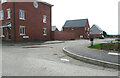
The property market in CT1 1QH is dominated by rental properties, with only 27% of homes owned by residents. This suggests a strong tenant-driven market, likely influenced by Canterbury’s student population and the presence of Canterbury Christ Church University. The accommodation type is primarily houses, which, given the area’s small size, implies a mix of modest to mid-sized properties. However, the high population density—44,773 people per square kilometre—means that housing stock is limited and closely packed. For buyers, this small area offers few opportunities for purchase, with most properties available for rent. The proximity to Canterbury’s amenities may make it appealing to those seeking short-term rentals or investment in student housing. However, the lack of data on property prices or availability means that the market’s specifics remain opaque, requiring further local insight.
House Prices in CT1 1QH
No properties found in this postcode.
Energy Efficiency in CT1 1QH
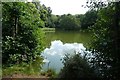
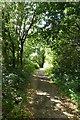
Living in CT1 1QH offers access to essential retail and transport hubs within practical reach. The area is near Farmfoods Canterbury, Sainsburys Canterbury, and Waitrose Canterbury, providing a range of grocery and retail options. These stores cater to daily needs, from fresh produce to household goods, ensuring convenience for residents. The proximity to Canterbury West, Canterbury East, and Sturry railway stations enhances mobility, linking the area to broader transport networks. While the small size of CT1 1QH means limited local parks or leisure facilities, its location within Canterbury grants access to the city’s historic sites, green spaces, and cultural attractions. The blend of retail, transport, and historic surroundings creates a lifestyle that balances practicality with the charm of a historic city. However, the compact nature of the area means that residents may need to venture beyond CT1 1QH for more extensive recreational or leisure opportunities.
Amenities
Schools
Residents of CT1 1QH have access to Barton Court Grammar School, which operates as both a primary school and an academy with a ‘good’ Ofsted rating. This dual role suggests it serves both younger children and older students, potentially offering a seamless educational pathway. Nearby, Canterbury Christ Church University provides higher education opportunities, adding to the area’s academic vibrancy. The presence of a well-rated primary school and a university within close proximity makes CT1 1QH attractive for families seeking a range of educational options. However, the absence of secondary schools in the immediate vicinity may require students to commute to other parts of Canterbury. The mix of school types indicates a community that supports both early education and higher learning, though families with children in secondary education may need to consider travel time to other institutions.
| Rank | School | Type | Entry gender | Ages |
|---|---|---|---|---|
| 1 | Barton Court Grammar School | primary | N/A | N/A |
| 2 | Canterbury Christ Church University | other | N/A | N/A |
| 3 | Barton Court Grammar School | academy | N/A | N/A |
Explore more schools in this area
Go to Schools tabDemographics
The population of CT1 1QH is overwhelmingly young, with a median age of 22 and the majority of residents aged 15–29. This reflects a community dominated by students and young professionals, likely drawn by Canterbury’s educational institutions. Home ownership is low at 27%, indicating that most residents rent their homes, which may contribute to a transient population. The area is predominantly composed of houses, though the population density—44,773 people per square kilometre—suggests that properties are closely spaced. The predominant ethnic group is White, with no specific data on other demographics. The high proportion of young adults and the low home ownership rate suggest a dynamic but potentially less stable community, where temporary housing needs may outweigh long-term residency. The area’s character is defined by its youthful energy, though the high density could impact living space quality and community cohesion.
Household Size
Accommodation Type
Tenure
Ethnic Group
Religion
Household Composition
Age
Household Deprivation
NS-SEC
Explore more demographic insights in this area
Go to Demographics tabPlanning
Planning Constraints
- Flood RiskPremium
- Ramsar Wetland SitesPremium
- Area of Outstanding Natural BeautyPremium
- Protected Nature ReservePremium
- Protected WoodlandPremium
- Crime RiskPremium