Area Overview for CT1 1GT
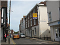
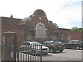
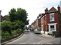
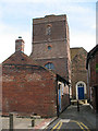
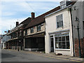
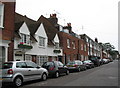
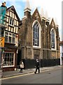
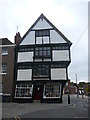
Photos of CT1 1GT
Area Information
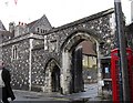
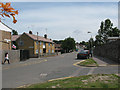
Living in CT1 1GT means inhabiting a compact, densely populated residential cluster in Canterbury, Kent. With a population of 2,868 spread over just 1,208 square metres, this area is characterised by its high population density—over 2.3 million people per square kilometre. Historically, it is part of Northgate Ward, named after the medieval North Gate in Canterbury’s ancient walls. Today, the area retains echoes of its past, including the site of the demolished North Gate and St Mary Northgate Church, now owned by King’s School. Daily life here is shaped by proximity to Canterbury’s city centre, with easy access to rail links, retail hubs, and community spaces. The area’s small size and high density mean residents are likely to know their neighbours, though the compact nature can also create a sense of limited space. For those seeking a mix of history and modern convenience, CT1 1GT offers a unique blend of urban living and historical significance.
- Area Type
- Postcode
- Area Size
- 1208 m²
- Population
- Not available
- Population Density
- Not available
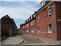
The property market in CT1 1GT is dominated by rental homes, with only 29% of households owning their properties. The accommodation type is primarily houses, suggesting a focus on family homes or multi-generational living. Given the area’s small size and high population density, housing stock is likely limited, with competition for available properties. Buyers should consider the proximity to Canterbury’s city centre, which offers access to amenities but may also drive up demand. The high population density could mean properties are smaller or more tightly packed than in surrounding areas. For those seeking owner-occupation, the low home ownership rate may indicate challenges in securing a purchase, though the presence of houses suggests opportunities for those prioritising space.
House Prices in CT1 1GT
No properties found in this postcode.
Energy Efficiency in CT1 1GT
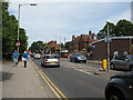
CT1 1GT offers a range of amenities within walking or short driving distance. Retail options include major supermarkets such as Farmfoods Canterbury, Sainsburys Canterbury, and Asda Canterbury, ensuring easy access to groceries and everyday essentials. The area’s rail connections—Canterbury West, East, and Sturry stations—provide links to broader transport networks, enhancing mobility. While specific parks or leisure facilities are not detailed in the data, the proximity to Canterbury’s city centre likely means access to green spaces, cultural venues, and community hubs. The Northgate Ward Community Centre, established in 1997, adds to the area’s social fabric, offering local events and services. This mix of retail, transport, and community resources supports a convenient, connected lifestyle.
Amenities
Schools
Near CT1 1GT are Parkside Community Primary School, rated ‘good’ by Ofsted, and The Willows, which is categorised as ‘other’—possibly a secondary or specialist school. The presence of a primary school with a strong rating is a significant draw for families, offering a solid foundation for younger children. The mix of school types suggests a range of educational options, though specifics about The Willows are not detailed in the data. Families may benefit from the proximity to both primary and secondary-level education, though the absence of data on The Willows’ exact role or performance means further research would be needed to assess its suitability.
| Rank | School | Type | Entry gender | Ages |
|---|---|---|---|---|
| 1 | Parkside Community Primary School | primary | N/A | N/A |
| 2 | The Willows | other | N/A | N/A |
Explore more schools in this area
Go to Schools tabDemographics
CT1 1GT has a median age of 22, with the majority of residents aged 15–29. This reflects a young, dynamic population, likely drawn to Canterbury’s educational and employment opportunities. Only 29% of households are owner-occupied, indicating a rental-dominated market, while the predominant accommodation type is houses. The area’s demographic is largely White, with no specific data on other ethnic groups. The high population density—over 2.3 million per square kilometre—suggests a mix of students, young professionals, and families. This density can influence local services, with amenities and transport options tailored to a youthful, mobile population. However, the low home ownership rate may affect long-term community stability, with residents often moving frequently.
Household Size
Accommodation Type
Tenure
Ethnic Group
Religion
Household Composition
Age
Household Deprivation
NS-SEC
Explore more demographic insights in this area
Go to Demographics tabPlanning
Planning Constraints
- Flood RiskPremium
- Ramsar Wetland SitesPremium
- Area of Outstanding Natural BeautyPremium
- Protected Nature ReservePremium
- Protected WoodlandPremium