Area Overview for CT1 1GF
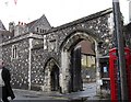
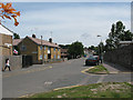
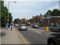
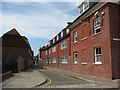
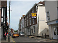
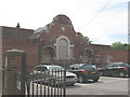
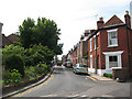
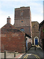
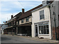
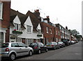
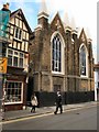
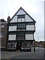
Photos of CT1 1GF
Area Information
Living in CT1 1GF means being part of a compact, densely populated residential cluster in Canterbury, Kent. This postcode area, covering 8,429 m², is home to 2,868 people, creating a high population density of 340,272 per km². Historically, the area falls within Northgate Ward, once governed by medieval walls and gates that shaped Canterbury’s development. Today, it retains a sense of rootedness, with proximity to the city’s core and its historic landmarks. The area’s small size means residents are close to Canterbury’s amenities, including shops, transport hubs, and cultural sites. With a median age of 22, the community is young, reflecting a demographic skewed toward young adults. This dynamic age profile suggests a mix of students, professionals, and families seeking affordability in a historic city. The area’s character is defined by its proximity to both heritage and modern convenience, making it appealing to those who value accessibility without sacrificing historical context.
- Area Type
- Postcode
- Area Size
- 8429 m²
- Population
- Not available
- Population Density
- Not available
The property market in CT1 1GF is characterised by a low home ownership rate (29%) and a focus on houses as the primary accommodation type. This suggests a rental-dominated market, with limited owner-occupied properties. Given the area’s small size and high population density, houses are likely to be smaller or terraced, reflecting the constraints of the postcode’s limited land area. For buyers, this means competition for available properties and potential challenges in securing a home, particularly in a historically significant city like Canterbury. The rental market may offer more immediate availability, though prices could be influenced by the area’s proximity to transport links and amenities. Prospective buyers should consider the transient nature of the community, as well as the need for flexibility in housing choices within a tightly packed postcode.
House Prices in CT1 1GF
No properties found in this postcode.
Energy Efficiency in CT1 1GF
Residents of CT1 1GF have access to a range of nearby amenities, including five retail venues such as Farmfoods Canterbury, Asda Canterbury, and Aldi Sturry. These shops provide convenience for daily errands, from groceries to household essentials. The area’s proximity to multiple railway stations also enhances mobility, allowing quick access to Canterbury’s cultural and commercial hubs. While the data does not specify parks or leisure facilities, the compact nature of the postcode suggests that residents can reach larger green spaces or recreational areas within a short distance. The mix of retail and transport options contributes to a practical lifestyle, where daily needs are met efficiently. The area’s character is defined by its accessibility, making it ideal for those who prioritise convenience without sacrificing the charm of a historic city.
Amenities
Schools
Near CT1 1GF, Parkside Community Primary School is a notable institution, rated ‘good’ by Ofsted. This primary school serves the area’s younger residents, offering a solid foundation for local children. The Willows, another nearby school, is listed as ‘other’, though its specific type is not detailed in the data. The presence of a primary school with a strong rating is a significant asset for families, ensuring access to quality early education. However, the absence of secondary school details means families may need to look beyond the immediate area for comprehensive schooling. The mix of school types suggests a focus on primary education, which could be a consideration for those prioritising proximity to schools for younger children.
| Rank | School | Type | Entry gender | Ages |
|---|---|---|---|---|
| 1 | Parkside Community Primary School | primary | N/A | N/A |
| 2 | The Willows | other | N/A | N/A |
Explore more schools in this area
Go to Schools tabDemographics
CT1 1GF has a median age of 22, with the most common age range being 15–29 years. This indicates a community dominated by young adults, likely including students and early-career professionals. Home ownership stands at 29%, meaning most residents rent their homes, which may reflect the area’s transient nature or affordability pressures. The predominant accommodation type is houses, though the high population density suggests these are likely smaller or terraced properties. The predominant ethnic group is White, with no specific data on other demographics. The low home ownership rate and youthful profile imply a community that may be more fluid than settled, with residents potentially moving frequently. This dynamic could influence local services and amenities, which must cater to a shifting population. The area’s compact size and high density also mean shared spaces and communal living may be more common than in larger suburbs.
Household Size
Accommodation Type
Tenure
Ethnic Group
Religion
Household Composition
Age
Household Deprivation
NS-SEC
Explore more demographic insights in this area
Go to Demographics tabPlanning
Planning Constraints
- Flood RiskPremium
- Ramsar Wetland SitesPremium
- Area of Outstanding Natural BeautyPremium
- Protected Nature ReservePremium
- Protected WoodlandPremium
- Crime RiskPremium