Area Overview for CT1 1AR
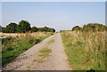
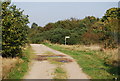
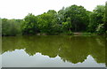
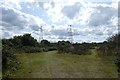
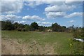
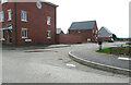
Photos of CT1 1AR


Area Information
CT1 1AR is a small residential postcode cluster in Canterbury, Kent, nestled within the historic city’s UNESCO World Heritage Site. The area covers 4,188 square metres and is home to 2,085 residents, creating a compact, densely populated community with a population density of 1,037 people per square kilometre. This postcode lies within Barton Ward, an electoral area with ties to Canterbury’s medieval past, including landmarks like Barton Hall and historic hospitals such as Jesus Hospital. The proximity to Canterbury’s ancient core offers residents a blend of historical significance and modern convenience. Daily life here is shaped by the city’s heritage, with easy access to its cultural and civic amenities. The area’s small size means a tight-knit community feel, though the high population density may influence local dynamics. Residents benefit from Canterbury’s well-established infrastructure, including transport links and retail options, while the surrounding landscape remains largely urban, reflecting the city’s medieval planning. This postcode is ideal for those seeking a balance between historical charm and practical living, though its compact nature means space is at a premium.
- Area Type
- Postcode
- Area Size
- 4188 m²
- Population
- 2085
- Population Density
- 1037 people/km²
The property market in CT1 1AR is characterised by a low home ownership rate of 36%, indicating that the majority of properties are rented rather than owned. This suggests a rental market dominated by private landlords or housing associations, with limited opportunities for buyers seeking owner-occupied homes. The accommodation type is primarily houses, which, given the area’s small size, may mean properties are smaller or more densely packed. The high population density of 1,037 people per square kilometre further implies limited space for new developments, potentially keeping property availability constrained. Buyers should consider the area’s compact nature and the prevalence of rental properties when evaluating long-term investment potential. The focus on houses may appeal to those prioritising private living spaces, though the small footprint of the postcode means competition for properties is likely. Those seeking owner-occupied homes may find the market challenging, with fewer options compared to surrounding areas.
House Prices in CT1 1AR
No properties found in this postcode.
Energy Efficiency in CT1 1AR
Residents of CT1 1AR have access to a range of nearby amenities, including five retail outlets such as Aldi Sturry, Farmfoods Canterbury, and Iceland Stour RP, providing essential shopping options within practical reach. The area’s proximity to multiple railway stations, including Canterbury West and Sturry, ensures easy access to public transport, supporting both daily commuting and weekend excursions. While the data does not specify parks or leisure facilities, the area’s historical context and location within Canterbury’s UNESCO site suggest opportunities for cultural and heritage-based activities. The presence of retail and transport hubs enhances convenience, allowing residents to meet daily needs without long journeys. The compact nature of the postcode means amenities are closely clustered, fostering a sense of accessibility. However, the lack of detailed information on leisure options means potential residents should explore the broader Canterbury area for additional recreational opportunities. The combination of retail, rail, and historical surroundings contributes to a functional lifestyle in this small but connected community.
Amenities
Schools
| Rank | School | Type | Entry gender | Ages |
|---|
Explore more schools in this area
Go to Schools tabDemographics
The population of CT1 1AR has a median age of 22, but the most common age group is adults aged 30–64, indicating a mix of young professionals and middle-aged residents. Only 36% of households are owner-occupied, suggesting a higher proportion of renters, which may influence the local property market. The predominant accommodation type is houses, though the small area size and high density imply limited space for expansion. The predominant ethnic group is White, reflecting Canterbury’s demographic profile. The data does not provide specific information on deprivation levels, but the high population density and 36% home ownership rate may suggest a mix of socioeconomic backgrounds. For quality of life, the age profile suggests a stable community with a focus on adult needs, though the lack of younger families may shape local amenities and services. The area’s compact nature may also influence social interactions, fostering a close-knit environment.
Household Size
Accommodation Type
Tenure
Ethnic Group
Religion
Household Composition
Age
Household Deprivation
NS-SEC
Explore more demographic insights in this area
Go to Demographics tabPlanning
Planning Constraints
- Flood RiskPremium
- Ramsar Wetland SitesPremium
- Area of Outstanding Natural BeautyPremium
- Protected Nature ReservePremium
- Protected WoodlandPremium
- Crime RiskPremium