Area Overview for CT1 1AQ
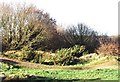
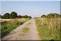
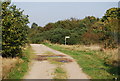
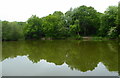
Photos of CT1 1AQ


Area Information
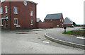
Living in CT1 1AQ means being part of a compact, residential cluster nestled within Canterbury’s historic boundaries. This postcode area, covering 4,943 square metres, is home to 2,085 people, with a population density of 1,037 per square kilometre. It falls within Barton Ward, a historic electoral division that includes sites like Barton Hall, linked to the Culpeper family, and medieval precincts noted in 17th-century records. The area is part of Canterbury, a UNESCO World Heritage Site, blending ancient heritage with modern living. Daily life here is shaped by proximity to the city’s landmarks and a network of nearby amenities. While the population is small, the area’s density suggests a tight-knit community. Residents benefit from Canterbury’s cultural and historical significance, with easy access to rail links and retail hubs. The mix of historic and contemporary features makes CT1 1AQ a unique blend of tradition and practicality for those seeking a compact, connected lifestyle.
- Area Type
- Postcode
- Area Size
- 4943 m²
- Population
- 2085
- Population Density
- 1037 people/km²
The property market in CT1 1AQ is defined by a 36% home ownership rate, meaning nearly two-thirds of residents rent their homes. This suggests a rental-driven market, possibly influenced by Canterbury’s status as a historic city with limited new housing development. The area’s accommodation is predominantly houses, which may appeal to families or those seeking more space. Given the small size of the postcode area and its integration with Canterbury’s broader housing stock, buyers should consider the limited availability of properties here. The focus on owner-occupied homes may indicate a stable, long-term resident base, but the rental proportion highlights competition for available properties. For buyers, this means a potential emphasis on established homes rather than new builds, with prices likely reflecting Canterbury’s historic and cultural value.
House Prices in CT1 1AQ
No properties found in this postcode.
Energy Efficiency in CT1 1AQ
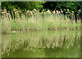
Residents of CT1 1AQ have access to a range of nearby amenities, including five retail outlets such as Aldi Sturry, Farmfoods Canterbury, and Asda Canterbury. These stores provide essential shopping and grocery needs within practical reach. The area’s rail connectivity, with five stations including Canterbury West and Sturry, ensures easy access to the city’s cultural and economic hubs. While specific details on parks or leisure facilities are not provided, the proximity to Canterbury’s historic sites and the city’s broader amenities suggest opportunities for walking, cycling, and cultural engagement. The compact nature of the area means residents can combine practical shopping with efficient commuting, creating a lifestyle that balances convenience with access to Canterbury’s historic and modern offerings.
Amenities
Schools
| Rank | School | Type | Entry gender | Ages |
|---|
Explore more schools in this area
Go to Schools tabDemographics
The community in CT1 1AQ is predominantly composed of adults aged 30–64, with a median age of 22. This suggests a mix of middle-aged residents and younger individuals, possibly including students or professionals working in Canterbury. Home ownership stands at 36%, indicating a significant portion of the population rents. The area is characterised by houses rather than flats or apartments, reflecting a more traditional housing stock. The predominant ethnic group is White, though specific diversity statistics are not provided. The population density of 1,037 per square kilometre implies a moderately compact living environment, which may influence social dynamics and local services. While no data on deprivation is available, the high proportion of renters and the age profile suggest a community that may prioritise affordability and proximity to employment over long-term property investment.
Household Size
Accommodation Type
Tenure
Ethnic Group
Religion
Household Composition
Age
Household Deprivation
NS-SEC
Explore more demographic insights in this area
Go to Demographics tabPlanning
Planning Constraints
- Flood RiskPremium
- Ramsar Wetland SitesPremium
- Area of Outstanding Natural BeautyPremium
- Protected Nature ReservePremium
- Protected WoodlandPremium
- Crime RiskPremium