Area Overview for CR6 9HG
Photos of CR6 9HG
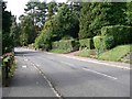
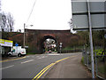

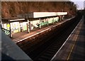
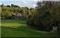


36 photos from this area
Area Information
Key information about the CR6 9HG including its size, population, and administrative classification.
- Area Type
- Postcode
- Area Size
- 5.1 hectares
- Population
- 2039
- Population Density
- 1780 people/km²
House Prices in CR6 9HG
51
Properties
£873,291
Average Sold Price
£230,000
Lowest Price
£1,500,000
Highest Price
Showing 51 properties
| Address | Type | Beds | Baths | Last Sale Price | Last Sale Date | |
|---|---|---|---|---|---|---|
| 113 Westhall Road, Warlingham, CR6 9HG | Detached | 4 | 2 | £825,000 | Mar 2024 | |
| 87 Westhall Road, Warlingham, CR6 9HG | Bungalow | 2 | - | £1,155,000 | Sep 2022 | |
| 71B Westhall Road, Warlingham, CR6 9HG | house | - | - | £907,171 | May 2021 | |
| 75 Westhall Road, Warlingham, CR6 9HG | Detached | 5 | - | £1,400,000 | Mar 2021 | |
| 73 Westhall Road, Warlingham, CR6 9HG | house | - | - | £1,365,000 | Feb 2021 | |
| 97 Westhall Road, Warlingham, CR6 9HG | Detached | 5 | - | £1,500,000 | Dec 2020 | |
| Ascot House, 81 Westhall Road, Warlingham, CR6 9HG | Detached | 5 | - | £1,375,000 | Nov 2020 | |
| 67 Westhall Road, Warlingham, CR6 9HG | Detached | 5 | - | £825,000 | Apr 2019 | |
| Loom House, 107A Westhall Road, Warlingham, CR6 9HG | house | - | - | £380,000 | Mar 2019 | |
| 77A Westhall Road, Warlingham, CR6 9HG | house | - | - | £1,060,000 | May 2018 |
Page 1 of 6
Energy Efficiency in CR6 9HG
Amenities
Schools
| Rank | School | Type | Entry gender | Ages |
|---|
Explore more schools in this area
Go to Schools tabDemographics
Household Size
Two person
most common
Accommodation Type
Houses
most common
Tenure
90
majority
Ethnic Group
White
most common
Religion
N/A
most common
Household Composition
N/A
most common
Age
47
median
Adults (30-64 years)
most common
Household Deprivation
N/A
with no deprivation
NS-SEC
57
in Lower managerial occupations
Explore more demographic insights in this area
Go to Demographics tabPlanning
Planning Constraints
- Flood RiskPremium
- Ramsar Wetland SitesPremium
- Area of Outstanding Natural BeautyPremium
- Protected Nature ReservePremium
- Protected WoodlandPremium