Area Overview for BR6 7PR
Photos of BR6 7PR
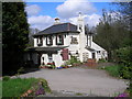
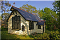
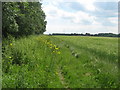
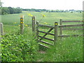
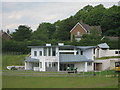
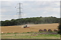

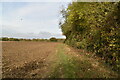
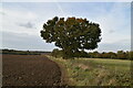
49 photos from this area
Area Information
Key information about the BR6 7PR including its size, population, and administrative classification.
- Area Type
- Postcode
- Area Size
- 14.2 hectares
- Population
- 1990
- Population Density
- 198 people/km²
House Prices in BR6 7PR
25
Properties
£713,955
Average Sold Price
£195,000
Lowest Price
£1,325,000
Highest Price
Showing 25 properties
| Address | Type | Beds | Baths | Last Sale Price | Last Sale Date | |
|---|---|---|---|---|---|---|
| Hill Top, Well Hill, Orpington, BR6 7PR | house | - | - | £756,000 | Sep 2021 | |
| Prospect Cottage, Well Hill, Orpington, BR6 7PR | Detached | 3 | 2 | £1,115,000 | Nov 2020 | |
| Cheviot, Well Hill, Orpington, BR6 7PR | Bungalow | 4 | 2 | £605,000 | Nov 2019 | |
| Forbury, Well Hill, Orpington, BR6 7PR | house | - | - | £750,000 | May 2019 | |
| Well Hill House, Well Hill, Orpington, BR6 7PR | Detached | 6 | 2 | £1,325,000 | Nov 2018 | |
| Greenacres, Well Hill, Orpington, BR6 7PR | Bungalow | 4 | 1 | £730,000 | Dec 2017 | |
| Spring Croft, Well Hill, Orpington, BR6 7PR | Bungalow | - | - | £625,000 | Jun 2012 | |
| The Paddocks, Well Hill, Orpington, BR6 7PR | Detached | 4 | 2 | £780,000 | May 2010 | |
| Rock Orchard, Well Hill, Orpington, BR6 7PR | Detached | - | - | £722,500 | May 2007 | |
| Beeches, Well Hill, Orpington, BR6 7PR | Detached | - | - | £250,000 | Jun 1999 |
Page 1 of 3
Energy Efficiency in BR6 7PR
Amenities
Schools
| Rank | School | Type | Entry gender | Ages |
|---|
Explore more schools in this area
Go to Schools tabDemographics
Household Size
Two person
most common
Accommodation Type
Houses
most common
Tenure
74
majority
Ethnic Group
White
most common
Religion
N/A
most common
Household Composition
N/A
most common
Age
47
median
Adults (30-64 years)
most common
Household Deprivation
N/A
with no deprivation
NS-SEC
35
in Lower managerial occupations
Explore more demographic insights in this area
Go to Demographics tabPlanning
Planning Constraints
- Flood RiskPremium
- Ramsar Wetland SitesPremium
- Area of Outstanding Natural BeautyPremium
- Protected Nature ReservePremium
- Protected WoodlandPremium