Area Overview for BN7 1PP
Photos of BN7 1PP
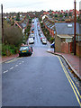
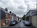
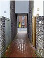
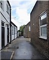
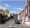
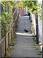
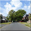
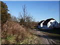
100 photos from this area
Area Information
Key information about the BN7 1PP including its size, population, and administrative classification.
- Area Type
- Postcode
- Area Size
- 7248 m²
- Population
- 1413
- Population Density
- 2559 people/km²
House Prices in BN7 1PP
20
Properties
£327,497
Average Sold Price
£91,000
Lowest Price
£520,000
Highest Price
Showing 20 properties
| Address | Type | Beds | Baths | Last Sale Price | Last Sale Date | |
|---|---|---|---|---|---|---|
| 35 Fitzjohns Road, Lewes, BN7 1PP | Semi-detached | - | - | £520,000 | Mar 2021 | |
| 9 Fitzjohns Road, Lewes, BN7 1PP | house | - | - | £480,000 | Dec 2018 | |
| 15 Fitzjohns Road, Lewes, BN7 1PP | Semi-detached | 3 | 1 | £470,000 | May 2018 | |
| 13 Fitzjohns Road, Lewes, BN7 1PP | Semi-detached | 3 | - | £476,000 | Aug 2016 | |
| 1 Fitzjohns Road, Lewes, BN7 1PP | Semi-detached | 3 | - | £370,000 | Mar 2014 | |
| 3 Fitzjohns Road, Lewes, BN7 1PP | house | - | - | £395,000 | Nov 2013 | |
| 17 Fitzjohns Road, Lewes, BN7 1PP | house | - | - | £340,000 | Nov 2012 | |
| 37 Fitzjohns Road, Lewes, BN7 1PP | Semi-detached | - | - | £385,000 | Jun 2012 | |
| 25 Fitzjohns Road, Lewes, BN7 1PP | Semi-detached | - | - | £295,000 | Sep 2005 | |
| 19 Fitzjohns Road, Lewes, BN7 1PP | Semi-detached | - | - | £242,000 | Oct 2003 |
Page 1 of 2
Energy Efficiency in BN7 1PP
Amenities
Schools
| Rank | School | Type | Entry gender | Ages |
|---|
Explore more schools in this area
Go to Schools tabDemographics
Household Size
Two person
most common
Accommodation Type
Houses
most common
Tenure
73
majority
Ethnic Group
White
most common
Religion
N/A
most common
Household Composition
N/A
most common
Age
47
median
Adults (30-64 years)
most common
Household Deprivation
N/A
with no deprivation
NS-SEC
50
in Lower managerial occupations
Explore more demographic insights in this area
Go to Demographics tabPlanning
Planning Constraints
- Flood RiskPremium
- Ramsar Wetland SitesPremium
- Area of Outstanding Natural BeautyPremium
- Protected Nature ReservePremium
- Protected WoodlandPremium