Area Overview for BN7 1BL
Photos of BN7 1BL
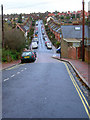
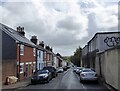
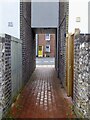
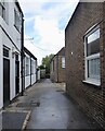
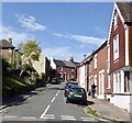
100 photos from this area
Area Information
Key information about the BN7 1BL including its size, population, and administrative classification.
- Area Type
- Postcode
- Area Size
- 5742 m²
- Population
- 1413
- Population Density
- 2559 people/km²
House Prices in BN7 1BL
7
Properties
£603,929
Average Sold Price
£242,500
Lowest Price
£1,000,000
Highest Price
Showing 7 properties
| Address | Type | Beds | Baths | Last Sale Price | Last Sale Date | |
|---|---|---|---|---|---|---|
| 31 Prince Edwards Road, Lewes, BN7 1BL | house | - | - | £1,000,000 | Oct 2019 | |
| 33 Prince Edwards Road, Lewes, BN7 1BL | house | - | - | £700,000 | Jan 2019 | |
| 25 Prince Edwards Road, Lewes, BN7 1BL | house | - | - | £835,000 | Mar 2016 | |
| 27 Prince Edwards Road, Lewes, BN7 1BL | house | - | - | £600,000 | Jul 2010 | |
| 23 Prince Edwards Road, Lewes, BN7 1BL | house | - | - | £555,000 | Jun 2010 | |
| 21 Prince Edwards Road, Lewes, BN7 1BL | Detached | 5 | 2 | £295,000 | Aug 2001 | |
| 29 Prince Edwards Road, Lewes, BN7 1BL | house | - | - | £242,500 | Jan 2000 |
Energy Efficiency in BN7 1BL
Amenities
Schools
| Rank | School | Type | Entry gender | Ages |
|---|
Explore more schools in this area
Go to Schools tabDemographics
Household Size
Two person
most common
Accommodation Type
Houses
most common
Tenure
73
majority
Ethnic Group
White
most common
Religion
N/A
most common
Household Composition
N/A
most common
Age
47
median
Adults (30-64 years)
most common
Household Deprivation
N/A
with no deprivation
NS-SEC
50
in Lower managerial occupations
Explore more demographic insights in this area
Go to Demographics tabPlanning
Planning Constraints
- Flood RiskPremium
- Ramsar Wetland SitesPremium
- Area of Outstanding Natural BeautyPremium
- Protected Nature ReservePremium
- Protected WoodlandPremium