Area Overview for BN3 7SD
Photos of BN3 7SD
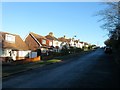
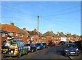
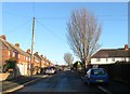
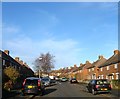
45 photos from this area
Area Information
Key information about the BN3 7SD including its size, population, and administrative classification.
- Area Type
- Postcode
- Area Size
- 5975 m²
- Population
- 1471
- Population Density
- 4433 people/km²
House Prices in BN3 7SD
18
Properties
£192,667
Average Sold Price
£57,000
Lowest Price
£270,000
Highest Price
Showing 18 properties
| Address | Type | Beds | Baths | Last Sale Price | Last Sale Date | |
|---|---|---|---|---|---|---|
| 19, Ryde Court, 134-138 Hangleton Road, Hove, BN3 7SD | Flat | 2 | 1 | £205,000 | Oct 2024 | |
| 5, Ryde Court, 134-138 Hangleton Road, Hove, BN3 7SD | Flat | 2 | 1 | £270,000 | Mar 2022 | |
| 7, Ryde Court, 134-138 Hangleton Road, Hove, BN3 7SD | Flat | - | - | £242,500 | Feb 2021 | |
| 16, Ryde Court, 134-138 Hangleton Road, Hove, BN3 7SD | Flat | - | - | £203,500 | May 2019 | |
| 6, Ryde Court, 134-138 Hangleton Road, Hove, BN3 7SD | Flat | - | - | £180,000 | Aug 2018 | |
| 12, Ryde Court, 134-138 Hangleton Road, Hove, BN3 7SD | Flat | - | - | £227,500 | Jul 2017 | |
| 3, Ryde Court, 134-138 Hangleton Road, Hove, BN3 7SD | Flat | 2 | 1 | £230,000 | Apr 2016 | |
| 8, Ryde Court, 134-138 Hangleton Road, Hove, BN3 7SD | Flat | - | - | £178,000 | Jan 2014 | |
| 18, Ryde Court, 134-138 Hangleton Road, Hove, BN3 7SD | Flat | - | - | £171,000 | Jan 2014 | |
| 15, Ryde Court, 134-138 Hangleton Road, Hove, BN3 7SD | Flat | - | - | £177,500 | Sep 2013 |
Page 1 of 2
Energy Efficiency in BN3 7SD
Amenities
Schools
| Rank | School | Type | Entry gender | Ages |
|---|
Explore more schools in this area
Go to Schools tabDemographics
Household Size
Family (3-5 people)
most common
Accommodation Type
Houses
most common
Tenure
82
majority
Ethnic Group
White
most common
Religion
N/A
most common
Household Composition
N/A
most common
Age
47
median
Adults (30-64 years)
most common
Household Deprivation
N/A
with no deprivation
NS-SEC
38
in Lower managerial occupations
Explore more demographic insights in this area
Go to Demographics tabPlanning
Planning Constraints
- Flood RiskPremium
- Ramsar Wetland SitesPremium
- Area of Outstanding Natural BeautyPremium
- Protected Nature ReservePremium
- Protected WoodlandPremium