Area Overview for BN3 1TD
Photos of BN3 1TD
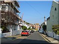
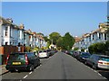
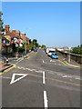
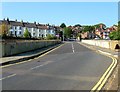
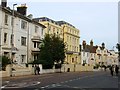
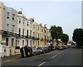
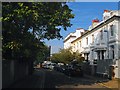
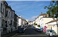
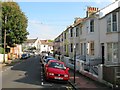
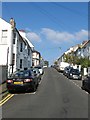
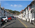
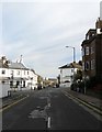
100 photos from this area
Area Information
Key information about the BN3 1TD including its size, population, and administrative classification.
- Area Type
- Postcode
- Area Size
- 5746 m²
- Population
- Not available
- Population Density
- Not available
House Prices in BN3 1TD
66
Properties
£624,688
Average Sold Price
£295,000
Lowest Price
£887,000
Highest Price
Showing 66 properties
| Address | Type | Beds | Baths | Last Sale Price | Last Sale Date | |
|---|---|---|---|---|---|---|
| 28, Richmond Court, 28 Osmond Road, Hove, BN3 1TD | Flat | 2 | 1 | £295,000 | Mar 2024 | |
| 33 Osmond Road, Hove, BN3 1TD | Maisonette | 3 | 2 | £555,000 | Aug 2023 | |
| 40 Osmond Road, Hove, BN3 1TD | house | - | - | £705,000 | Feb 2016 | |
| 39 Osmond Road, Hove, BN3 1TD | house | - | - | £735,500 | Aug 2014 | |
| 42 Osmond Road, Hove, BN3 1TD | Semi-detached | 5 | 2 | £887,000 | Jul 2014 | |
| 44 Osmond Road, Hove, BN3 1TD | Terraced | 6 | - | £630,000 | Jul 2013 | |
| 41 Osmond Road, Hove, BN3 1TD | Semi-detached | 4 | - | £690,000 | Apr 2011 | |
| 48 Osmond Road, Hove, BN3 1TD | Detached | - | - | £500,000 | Aug 2006 | |
| 29 Osmond Road, Hove, BN3 1TD | Detached | 5 | 2 | - | - | |
| Ground Floor Flat, 37 Osmond Road, Hove, BN3 1TD | Flat | 3 | 1 | - | - |
Page 1 of 7
Energy Efficiency in BN3 1TD
Amenities
Schools
| Rank | School | Type | Entry gender | Ages |
|---|
Explore more schools in this area
Go to Schools tabDemographics
Household Size
One person
most common
Accommodation Type
Flats
most common
Tenure
51
majority
Ethnic Group
White
most common
Religion
N/A
most common
Household Composition
N/A
most common
Age
47
median
Adults (30-64 years)
most common
Household Deprivation
N/A
with no deprivation
NS-SEC
49
in Lower managerial occupations
Explore more demographic insights in this area
Go to Demographics tabPlanning
Planning Constraints
- Flood RiskPremium
- Ramsar Wetland SitesPremium
- Area of Outstanding Natural BeautyPremium
- Protected Nature ReservePremium
- Protected WoodlandPremium