Area Overview for BN3 1TA
Photos of BN3 1TA
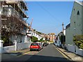
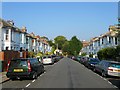
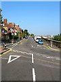
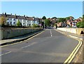
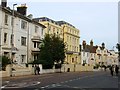
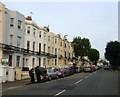
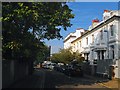
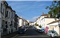
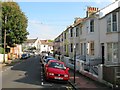
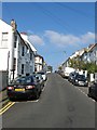
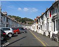
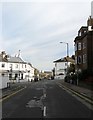
100 photos from this area
Area Information
Key information about the BN3 1TA including its size, population, and administrative classification.
- Area Type
- Postcode
- Area Size
- 4705 m²
- Population
- Not available
- Population Density
- Not available
House Prices in BN3 1TA
30
Properties
£602,923
Average Sold Price
£285,000
Lowest Price
£945,000
Highest Price
Showing 30 properties
| Address | Type | Beds | Baths | Last Sale Price | Last Sale Date | |
|---|---|---|---|---|---|---|
| 15 Colbourne Road, Hove, BN3 1TA | Terraced | 5 | 2 | £945,000 | Jan 2025 | |
| 39 Colbourne Road, Hove, BN3 1TA | Terraced | 5 | 3 | £825,000 | Jun 2024 | |
| 35 Colbourne Road, Hove, BN3 1TA | Semi-detached | 3 | 2 | £797,000 | Sep 2023 | |
| 31 Colbourne Road, Hove, BN3 1TA | Terraced | 5 | 2 | £900,000 | Mar 2023 | |
| 5 Colbourne Road, Hove, BN3 1TA | Semi-detached | 4 | - | £800,000 | Nov 2020 | |
| 37 Colbourne Road, Hove, BN3 1TA | Terraced | 4 | 2 | £615,000 | Jan 2020 | |
| 11 Colbourne Road, Hove, BN3 1TA | Semi-detached | 3 | 1 | £673,500 | Apr 2017 | |
| 25 Colbourne Road, Hove, BN3 1TA | Terraced | 4 | - | £545,000 | Sep 2014 | |
| 17 Colbourne Road, Hove, BN3 1TA | house | 4 | 1 | £350,000 | May 2011 | |
| 41 Colbourne Road, Hove, BN3 1TA | Detached | 4 | - | £402,500 | Sep 2010 |
Page 1 of 3
Energy Efficiency in BN3 1TA
Amenities
Schools
| Rank | School | Type | Entry gender | Ages |
|---|
Explore more schools in this area
Go to Schools tabDemographics
Household Size
Family (3-5 people)
most common
Accommodation Type
Houses
most common
Tenure
66
majority
Ethnic Group
White
most common
Religion
N/A
most common
Household Composition
N/A
most common
Age
47
median
Adults (30-64 years)
most common
Household Deprivation
N/A
with no deprivation
NS-SEC
55
in Lower managerial occupations
Explore more demographic insights in this area
Go to Demographics tabPlanning
Planning Constraints
- Flood RiskPremium
- Ramsar Wetland SitesPremium
- Area of Outstanding Natural BeautyPremium
- Protected Nature ReservePremium
- Protected WoodlandPremium